 Society

Lâm Đồng rolls out road-trip tourism packages to offset airport closure
1.
|
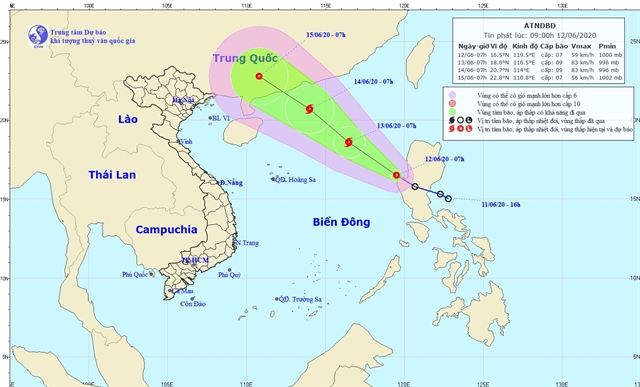
| The direction of the tropical depression. Photo courtesy of the National Centre for Hydro-meteorological Forecasting |
HÀ NỘI — A tropical depression has entered the South China Sea (called East Sea in Việt Nam) after crossing over Luzon island of the Philippines and is likely to strengthen into a storm, according to the National Centre for Hydro-Meteorological Forecasting (NCHMF).
At 7am on Friday the tropical depression was 90km west of Luzon island with wind speeds of 50-60km per hour near its centre.
Over the next 24 hours, the tropical depression is forecast to move northwest at a speed of 15km per hour and is likely to develop into a storm.
At 7am on Saturday, the storm’s eye is likely to be about 470km east-northeast of the Hoàng Sa (Paracel) Archipelago with maximum wind speeds reaching 90km per hour.
In the next 48 hours, the storm is likely to move northwest at 15-20kph. As of 7am on Sunday, the storm’s centre is expected to be 170km south of Hong Kong (China) with maximum wind speed of 90kph.
According to a report from the Ministry of Natural Resources and Environment, in 2020, there will be at least 11-13 storms in Việt Nam, of which five are likely to hit the East Sea, especially in the south, where there is not much experience in storm prevention. — VNS
Society
 Society
 Society
 Society
 Society
 Society
 Society
 Society
Using her skilled hands, she makes unique blankets with different kinds of fabric, colours and patterns
 Society
 Society
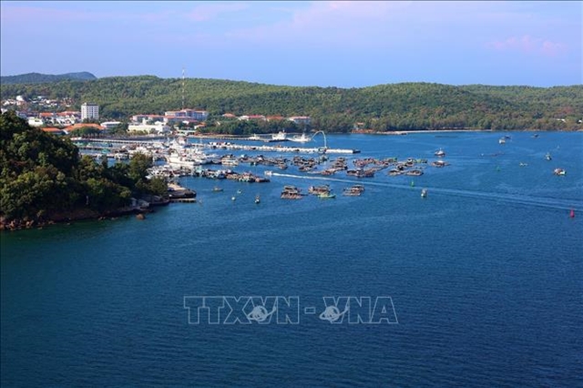
Local authorities have offered assistance to encourage fishermen to invest in fishing boats with higher capacity and to use technology to improve fishing capacity
 Society
 Society
 Society
Trần Quốc Hương, alias Mười Hương, was also the former head of the PCC’s Commission for Internal Affairs and former deputy head of the Central Organisation Committee.