 Society


|
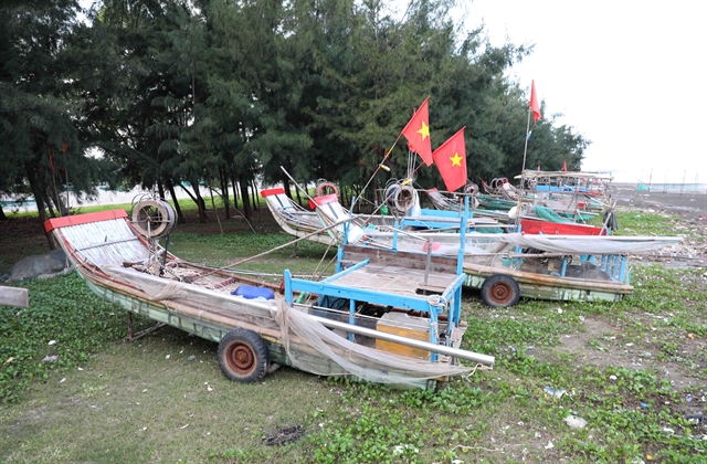
| Hundreds of fishing rafts and boats belonging to fishermen in Diễn Kim Commune (Diễn Châu District, Nghệ An Province) were pulled ashore and securely tied under the casuarina forest. VNA/VNS Photo Xuân Tiến |
NGHỆ AN Typhoon Trami, the sixth storm of the season in Việt Nam, is approaching the central provinces, prompting several provinces to issue bans on coastal activities, and implement flexible strategies to minimise damage to lives and property.
In Diễn Châu district, one of five coastal districts in Nghệ An Province, where more than 1,000 boats and rafts are present with over 500 dedicated to offshore fishing, fishermen have proactively taken precautionary measures.
For two days, from October 23 to 24, a large number of vessels have docked at the ports of Diễn Kim, Diễn Thủy, and Lạch Vạn. As of October 23, most large offshore fishing vessels have suspended operations. Phan Xuân Vinh, Vice Chairman of Diễn Châu’s People’s Committee, noted that the district has issued urgent notifications to local authorities, requiring them to closely monitor the storm’s progress, keep shipowners informed, and prepare emergency response teams for rescue operations as needed.
In Quảng Bình, on Saturday authorities announced a ban on all coastal activities from midnight on October 27 until the storm passes and the National Centre for Hydro-Meteorological Forecasting issues no further storm-related warnings. Relevant authorities have been instructed to maintain strict monitoring of the situation and ensure that no one underestimates the storm’s risks.
Quảng Bình’s Border Guard Command, Department of Agriculture and Rural Development, and coastal authorities are actively reviewing and informing shipowners and captains about the storm’s path and potential hazards. Measures are in place to safeguard tourism activities, aquaculture, and fishing operations along coastal and river areas, including the evacuation of aquaculture workers from rafts to safe areas.
In Quảng Trị, the Province's Chairman on Saturday issued directives for all coastal districts and Cồn Cỏ Island to work with the Border Guard and Maritime Authority to ensure the safe return of all fishing vessels. Additional measures include close monitoring of areas at risk of flooding, landslides, and strong waves, along with increased forecasting efforts to keep local authorities informed.
The province of Quảng Nam imposed a coastal ban for all fishing, passenger, and tourist boats starting at 10am. The ban will remain until conditions return to normal. Authorities have been tasked with preparing on-site emergency resources and reviewing safety protocols for dams and reservoirs.
The provincial Meteorological and Hydrological Station is responsible for issuing regular forecasts and monitoring river levels to aid in flood management. Relevant departments are overseeing mine extraction and power grid operations to prevent storm-related hazards.
The Phú Yên Provincial Steering Committee for Natural Disaster Prevention and Search and Rescue has instructed local authorities to be fully prepared under the "four on-the-spot" principle, ensuring sufficient personnel, resources, equipment, and provisions.
The province has nearly 2,000 fishing vessels, with close to 300 currently operating at sea, and all vessel owners have been informed of the storm’s path. According to Nguyễn Trọng Tùng, Deputy Head of Phú Yên’s Disaster Response Committee, proactive measures will be taken to prevent fishing during storm impact. Reservoir managers are instructed to closely monitor inflow levels, adjust water retention, and ensure safety downstream.
In Ninh Thuận, officials are closely coordinating with local agencies to regularly update residents on the storm’s progress. Local authorities are actively monitoring fishing vessel movements to prevent them from entering danger zones. The provincial Department of Fisheries confirms that all vessels from Ninh Thuận are currently fishing in southern waters, and communications are ongoing to ensure safe shelter.
Authorities are also overseeing aquaculture, livestock, and crop protection, and reservoir operations. Precautions are being taken to ensure safe evacuation of residents from vulnerable areas, particularly along the coast, rivers, and low-lying regions at high risk of storm surge and flooding.

|
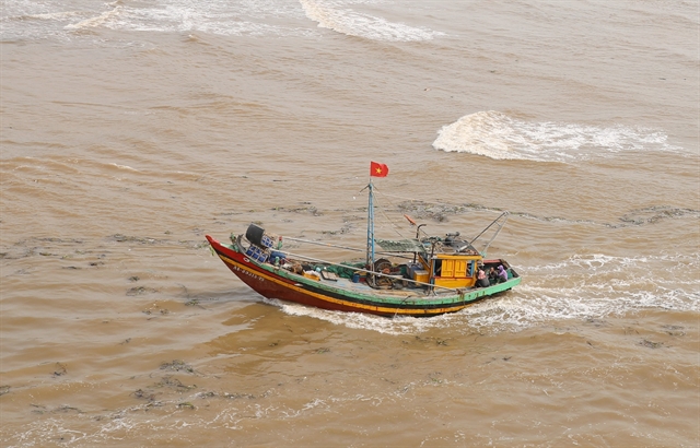
| Fishing boats of fishermen from Diễn Ngọc Commune (Diễn Châu District, Nghệ An Province) are docking amid strong winds and high waves. VNA/VNS Photo Xuân Tiến |
Trami to bring strong winds: NCHMF
Mai Văn Khiêm, Director of the National Centre for Hydro-Meteorological Forecasting, has reported that Typhoon Trami, characterised by a wide circulation area and unpredictable path, is poised to bring severe winds, high waves, potential sea surges, flash floods, landslides, and flooding in mountainous and low-lying areas from Hà Tĩnh to Bình Định and Northern Central Highlands urban areas.
As of 10am on October 26, a powerful storm was located northeast of the Hoàng Sa archipelago, approximately 510 km east-northeast of Đà Nẵng, with winds reaching level 11 (103-117 kph) and gusts up to level 14. The storm is moving west-southwest at roughly 20 kph.
Over the following days, the storm is expected to track west-southwest, approaching Central Việt Nam's offshore waters by October 27 with sustained winds at level 10-11 and gusts to level 14. Forecasts indicate a shift first to a southwest and then to an eastward direction along Central Việt Nam’s coast through October 29, with a gradual decrease in wind intensity, reaching level 8, gusting to level 10. Disaster risk remains at level 3 for affected areas throughout this period.
Due to the storm’s impact, the northwestern East Sea area will experience strong winds of level 8–9, and near the storm’s centre, winds may reach level 10–11 (89–117 km/h), gusting to level 14, with waves of 5–7 m and up to 7–9 m near the centre. The sea will be severely rough.
From Quảng Bình to Quảng Ngãi, including Cồn Cỏ, Cù Lao Chàm, and Lý Sơn islands, winds will reach level 6–7, increasing to level 8–9, and near the storm’s centre, level 10–11, gusting to level 14, with waves of 3–5 m and up to 5–7 m near the centre, causing severe rough seas.
From the morning of October 27, coastal areas from Quảng Bình to Quảng Nam may experience storm surges from 0.4 to 0.6 m. Boats in these dangerous areas (especially around the Hoàng Sa archipelago) and coastal areas from Quảng Bình to Quảng Ngãi are likely to be affected by thunderstorms, whirlwinds, strong winds, and large waves.

|
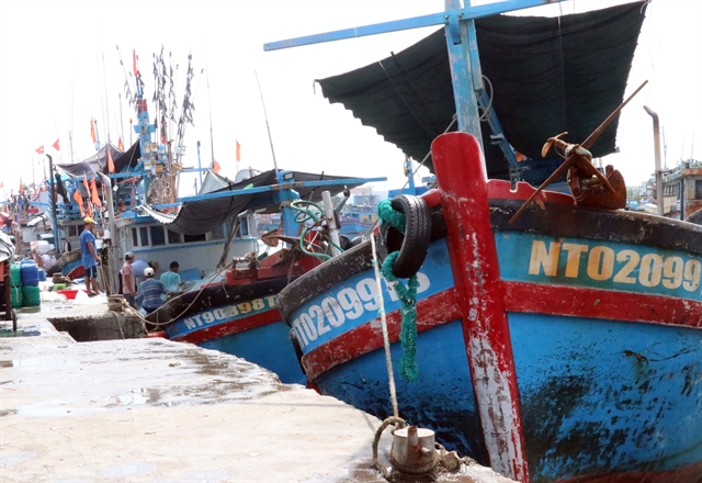
| Many boats have proactively docked at Đông Hải Fishing Port (Phan Rang-Tháp Chàm City) to take shelter from the storm. VNA/VNS Photo Công Thử |
There is a high risk of coastal embankment and dyke erosion from Quảng Trị to Quảng Nam due to large waves and storm surges.
From the morning of October 27, coastal areas from Quảng Bình to Quảng Ngãi will see winds intensifying to level 6–7, with areas near the storm’s centre reaching level 8–9, gusting to level 11.
From late afternoon and evening of October 26 to the night of October 28, Quảng Bình to Quảng Ngãi will experience heavy to very heavy rainfall, totalling 300–500 mm and locally over 700 mm. There is a warning of heavy rainfall with amounts exceeding 100 mm over 3 hours in some areas. Hà Tĩnh, Bình Định, and the northern Central Highlands will experience heavy rain, with some areas seeing totals of 100–200 mm and locally over 300 mm. VNS


