 Environment
Ministry of Foreign Affairs updates on rescue efforts after Khôi Nguyên 18 vessel sinks at sea
1.
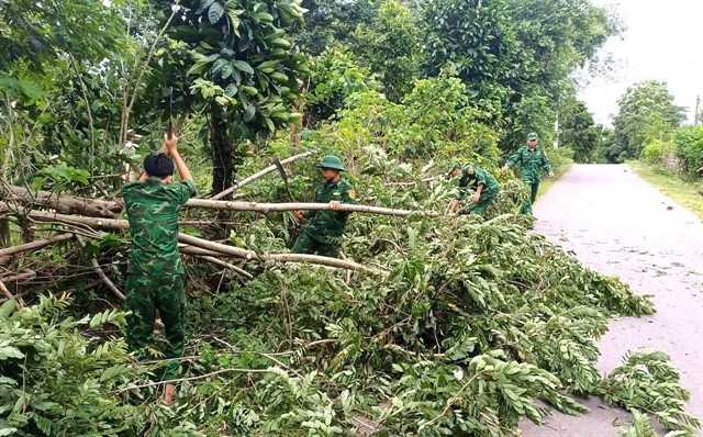 |
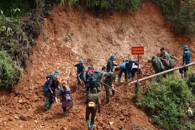
| Trees fell in the border region of Quảng Trị Province due to Typhoon Wipha on July 22. — VNA/VNS Photo |
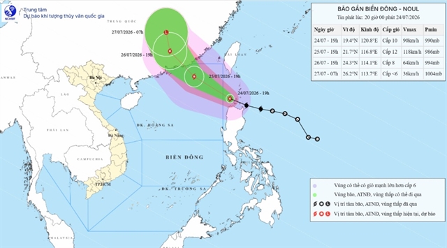
HÀ NỘI — Typhoon Wipha (locally known as storm No. 3) had weakened into a tropical depression, operating in northern provinces of Ninh Bình and Thanh Hoá by 7pm on July 22, the National Centre for Hydro-Meteorological Forecasting reported.
The centre said that the storm’s centre was located at approximately 20.1 degrees North latitude and 105.6–105.7 degrees East longitude, with wind speeds reaching level 6–7 (50–61km/h) and gusts up to level 9. The depression is moving west-southwest at a speed of around 10km/h.
It is forecast to continue weakening into a low-pressure area over northern Laos by the morning of July 23. Affected areas include the western part of the Gulf of Tonkin, coastal waters, and mainland areas of provinces from Quảng Ninh to Nghệ An, with disaster risk level 3.
Strong winds of level 6–7 and gusts of level 8–9 are expected offshore, with waves reaching 2–4 metres and rough seas. Coastal areas, especially aquaculture areas and maritime operations, have been deemed extremely dangerous due to strong winds, thunderstorms, and high waves.
On land, coastal and inland areas of provinces and cities such as Quảng Ninh, Hải Phòng, Ninh Bình, Thanh Hoá, and parts of Hưng Yen may experience gusts up to level 7.
Heavy rainfall between 40–80mm, with isolated totals exceeding 150mm, is expected from the evening of July 22 through the morning of July 23 in Thanh Hoá and Nghệ An provinces, and southern areas of Phú Thọ, and Sơn La provinces, posing risks of flash floods, landslides, and localised flooding in low-lying areas. — VNA/VNS
Environment
 Environment
 Environment
 Environment
 Environment
 Environment
 Environment
 Environment
 Environment
 Environment
 Environment
 Environment
 Environment
 Environment
 Environment
.jpg)