 Society


Art performances light up Khánh Hòa Sea Festival opening ceremony
1.
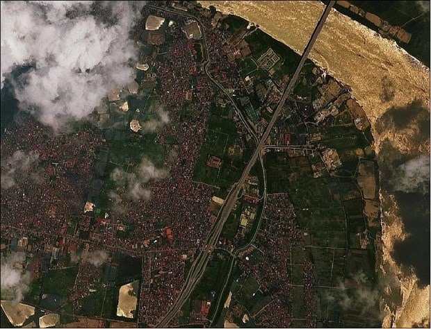
A research project by the Department of National Remote Sensing under the Ministry of Natural Resources and Environment (MoNRE) has for the first time used images provided by VNREDSat-1, Việt Nam’s very first remote sensing satellite, in calculating carbon dioxide emissions.
|
A photo was taken by VNREDSat-1 satellite. — Photo earth.esa.int
HÀ NỘI — A research project by the Department of National Remote Sensing under the Ministry of Natural Resources and Environment (MoNRE) has for the first time used images provided by VNREDSat-1, Việt Nam’s very first remote sensing satellite, in calculating carbon dioxide emissions.
Using the VNREDSat-1 imagery and geographic information system (GIS) application, the project completed digital databases on the ecological, soil and climate conditions of the country and the Tây Nguyên Central Highlands, as well as a database to calculate greenhouse gas emissions, while setting up maps for land cover in Tây Nguyên localities and its changes.
High-resolution images provided by VNDREDSat-1 help improve the accuracy of land-cover mapping, thus improving the reliability of calculation of the greenhouse gas emissions in different areas.
Director of the Ozone Layer Protection and Low Carbon Economy Development Centre under the MoNRE’s Climate Change Department Hà Quang Anh said that along with creating a giant stride in technology in Việt Nam, the project helps policy-makers outline effective measures to mitigate indiscriminate mining exploration, and promote environmental protection.
The project showed that changes in forest reserves, biomass, and land uses have great impacts on greenhouse gas emissions in energy and agriculture, 20 per cent of which is contributed by deforestation and changes in land use.
The Central Highlands, which accounts for 35.7 per cent of the country’s forest areas, absorbs 50 per cent of the nation’s total carbon dioxide emissions, the project reveals. — VNS
Society
 Society
 Society
 Society
 Society
 Society
.jpg) Society
Society
 Society
 Society
 Society
 Society
 Society
 Society
A Vietnamese drug dealer who smuggled migrants into the United Kingdom to work in cannabis farms has been jailed for 11 years.
 Society
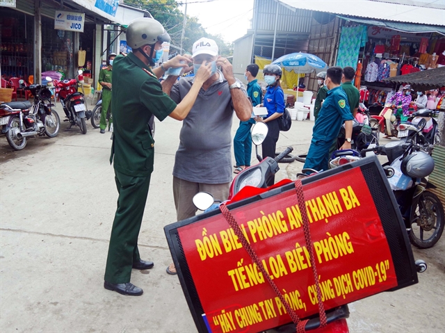
Over the last year, people living in border areas of the southern province of Sóc Trăng have gotten used to seeing border guards carry a loudspeaker on their motorbikes telling them how to protect themselves from COVID-19.
 Society
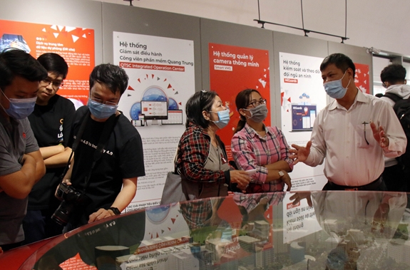
The Quang Trung Software Park in HCM City has inaugurated a museum displaying and introducing IT products and solutions created in the park over the past two decades.