 Society


Bắc Ninh targets full digital governance at all SOEs by 2030
1.
|
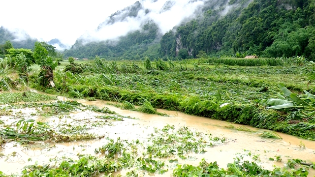
| Heavy rain on May 23 destroyed large areas of rice and maize in Lâm Bình District, Tuyên Quang Province. — VNA/VNS Photos |
HÀ NỘI — May has seen extraordinary and unseasonal weather phenomena across the country, including record-breaking rainfall, unexpected cold air surges and floods during the dry season.
Experts warn that these unusual conditions may signal a year of complex and severe natural disasters ahead.
Record rainfall and unseasonal cold fronts
According to Mai Văn Khiêm, Director of the National Centre for Hydrometeorological Forecasting, although the northern region has not yet entered the peak flood season, May has already experienced numerous dangerous weather events, including thunderstorms, tornadoes, lightning and hail.
Rainfall of 100-200mm within a few hours was recorded in areas such as Yến Dương Commune (Bắc Kạn Province), Na Hang District (Tuyên Quang Province), and Quảng Yên Township (Quảng Ninh Province).
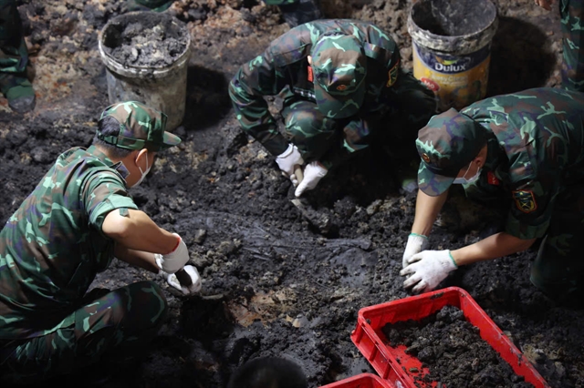
In Hà Tĩnh, typically hot and dry in May, flash floods struck unexpectedly from May 24-25.
Kỳ Giang Commune saw an unprecedented 601.4mm of rain and Hương Khê broke a 44-year rainfall record. Flood peaks on the Ngàn Sâu River reached historic May levels, submerging hundreds of homes and thousands of hectares of crops, and killing nearly 13,000 livestock and poultry.
Another unusual development this May was the strong cold air activity in the northern region.
A cold front moving into Việt Nam on May 25-26 extended as far south as the Central Coast, bringing widespread thunderstorms to the north and northern central regions.
Northern residents experienced cool weather resembling autumn, with temperatures dropping to 20-23 degree Celsius and below 19 degree Celsius in mountainous areas.
Nguyễn Văn Hưởng, Head of Weather Forecasting at the National Centre for Hydrometeorological Forecasting, explained that cold air appearing in May is not abnormal, as northern Việt Nam regularly receives cold spells in the first half of the month. However, cold air causing cooler temperatures in mountainous areas late in May is rare.
Cold air masses often originate from continental China, driven south by unusual monsoon wind patterns and upper atmospheric circulations. While cold air exists year-round, it is not always strong enough to affect Việt Nam’s mainland.
Forecasts from the National Centre for Hydrometeorological Forecasting predict that from the evening of May 28 to 29, cold air will continue to suppress low-pressure troughs, combined with upper-level wind convergence to cause moderate to very heavy rain in northern and north-central provinces. Rainfall in the north could range from 30 to 80mm, with some areas receiving up to 180mm.

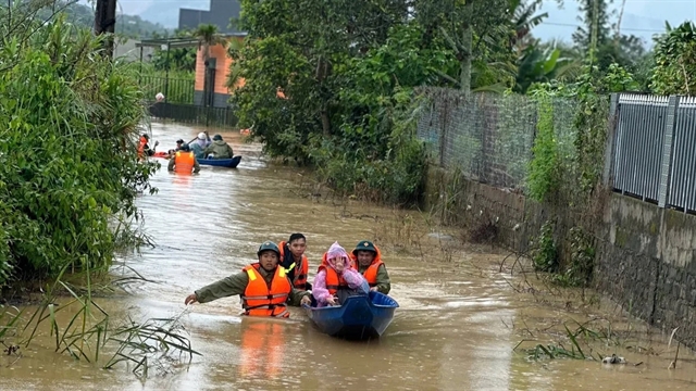
|
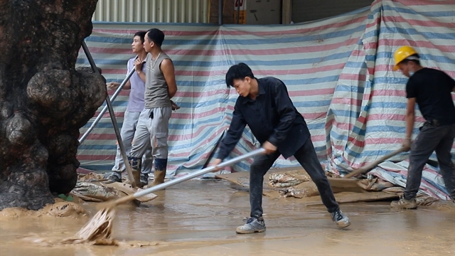
| Residents in flood-hit Cẩm Xuyên District, Hà Tĩnh Province, rush to harvest rice. |
From May 29 to 30, Thanh Hóa and Hà Tĩnh provinces may experience heavy rain of 40-70mm, with some spots exceeding 150mm.
Meteorologists warn of the risk of intense rainfall over 100mm within three hours, potentially causing localised flooding in low-lying areas, flash floods, and landslides in mountainous terrain.
Experts predict 2025 will see a significant increase in extreme weather events driven by climate change. Global temperatures are expected to rise, influenced by a neutral El Niño-Southern Oscillation (ENSO) phase, which is likely to contribute to more frequent heatwaves, stronger storms and increased flooding.
Khiêm anticipates temperatures in many areas will exceed long-term averages, particularly in northern and central provinces where severe heatwaves could pose serious public health risks.
In addition to heat, drought and saltwater intrusion will remain major challenges, especially in the Mekong Delta and Central regions, threatening agriculture and livelihoods. To mitigate these, efficient water management and the development of irrigation infrastructure alongside early warning systems will be essential.
Việt Nam is also expected to face numerous localised heavy rainfall events in mountainous and urban areas, raising the threat of severe flooding, flash floods, and landslides. Cities such as HCM City, Hà Nội, and the Mekong Delta require heightened vigilance.
Deputy Director of the National Centre for Hydrometeorological Forecasting, Hoàng Phúc Lâm, noted the likelihood of dangerous weather phenomena like storms, tornadoes, lightning and strong gusts that could severely impact production and public health.
Furthermore, the 2025 typhoon season may bring more frequent and intense storms, including super typhoons, causing significant human and material losses. Upgrading disaster prevention infrastructure and improving forecasting and early warning systems are critical for preparedness.
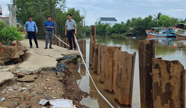
|
| Residents inpect damage caused by severe weather in Bạc Liêu Province. |
Coastal and marine threats grow
Tidal levels remain high from Vũng Tàu to Cà Mau, raising flood risks in low-lying coastal areas. Experts warn these tides will slow flood drainage in eastern southern river systems, increasing flooding and saltwater intrusion risks.
Authorities urge localities to monitor forecasts, prepare evacuation plans, clear waterways, protect infrastructure and aquaculture and safeguard crops to reduce damage.
At sea, scattered storms threaten the Gulf of Tonkin, central and southern coasts, and the Hoàng Sa (Paracel) and Trường Sa (Spratlys) archipelagos, with possible tornadoes, strong winds, and waves over two metres. Vessels are advised to exercise caution and maintain communication.
Experts call for forest protection, reservoir construction, drainage clearing, dyke building, and spillway reinforcement, along with detailed risk maps to support better land-use planning and resettlement. — VNS
Society
 Society
 Society
 Society
 Society
 Society
 Society
 Society
 Society
 Society
 Society
 Society
 Society
 Society
 Society