 Society
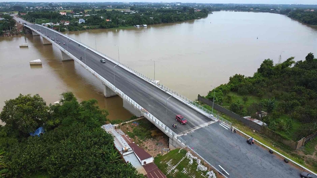
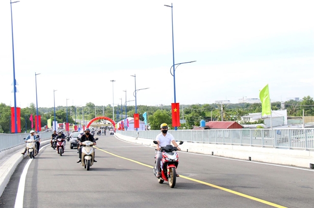
Bạch Đằng 2 Bridge opens, eases Đồng Nai – Bình Dương travel
Bạch Đằng 2 Bridge, which connects Đồng Nai Province with Bình Dương Province, was opened for traffic on September 2.
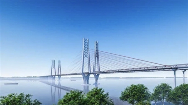 |
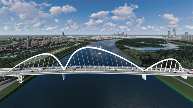
| Perspective of Cần Thơ Bridge 2 combining road and rail. VNA/VNS Photo |
HÀ NỘI – The Mỹ Thuận Project Management Board has proposed two options for constructing the Cần Thơ 2 Bridge, that is expected to start being built in 2026 and completed in 2029.
This project is crucial for completing the North-South expressway route in the eastern region of the Mekong Delta, connecting the Mỹ Thuận-Cần Thơ expressway with the Cần Thơ-Cà Mau expressway.
The two construction options for Cần Thơ 2 Bridge have estimated investment costs of approximately VNĐ9.8 trillion (US$815 million) and VNĐ27.5 trillion ($1.13 billion), respectively.
The first option proposes the construction of Cần Thơ 2 Bridge with separate lanes for road and rail. The bridge will have a main span length of 550m, using a composite steel girder structure with a reinforced concrete deck. The main bridge is 1,090m long.
This option has the advantage of separating road and rail traffic, enhancing safety and operational efficiency for both modes.
However, its drawback is the higher investment cost due to the need to construct two separate bridges.
The second option allows rail traffic to share lanes with road traffic. The bridge will also have a main span length of 550m but is expected to use a steel truss girder structure. The total length of the main bridge is 1,110m.
The advantage of this option is lower construction costs and a smaller land footprint, as it requires only one bridge. However, the drawback is that combining both types of traffic on a single bridge may present challenges in management, operation and maintenance.
Regarding total investment, option one (separate road and rail lanes) is estimated at VNĐ19,782 billion ($814.6 million) with construction and equipment costs accounting for VNĐ12,874 billion ($530 million), project management, consulting and other costs at VNĐ1,287 billion ($53 million), a contingency of VNĐ2,968 billion ($122.4 million) and compensation, support and resettlement costs of VNĐ2,653 billion ($109.2 million).
Option two (shared road and rail lanes) has a higher total investment, estimated at VNĐ27,494 billion ($1.13 billion) including construction and equipment costs of VNĐ18,544 billion ($764 million), project management, consulting, and other costs at VNĐ1,853 billion ($76.4 million), a contingency of VNĐ4,276 billion ($176 million) and compensation, support and resettlement costs of VNĐ2,821 billion ($116 million).
The Cần Thơ 2 Bridge project has a total length of about 14.65km and is located approximately 4.5km downstream from the existing Cần Thơ Bridge.
The approach road on the Vĩnh Long Province’s side is 8.38km long, with the main bridge and leading spans stretching 2.75km and the approach road and bridge on the Cần Thơ City’s side extending 3.52km.
The starting point of the project connects with the Chà Và intersection (end of the Mỹ Thuận-Cần Thơ Expressway project, located in Mỹ Hòa Commune, Bình Minh Town, Vĩnh Long Province), and the endpoint connects with the IC2 intersection, which intersects with National Route Nam Sông Hậu in Phú Thứ Ward, Cái Răng District (starting point of the Cần Thơ-Cà Mau Expressway).
The bridge will be designed with a navigational clearance width of 300m, with a main channel width of 160m and a height of 39m and side channels with a height of 30m.
The bridge deck width will be 24.75m, meeting the standard scale for a four-lane carriageway in line with TCVN 5729:2012 standards.
The approach road will also have a four-lane configuration, with a width of 24.75m, following expressway standards.
The project is expected to require a land clearance area of approximately 519.64ha.
According to the Mỹ Thuận Project Management Board, the investment project for the construction of Cần Thơ 2 Bridge is the final segment in the North-South expressway route in the eastern region of the Mekong Delta (connecting the Mỹ Thuận-Cần Thơ with the Cần Thơ-Cà Mau).
This is a key national expressway system, ensuring the continuous and high-speed transportation of large volumes of goods and passengers.
The project aims to create seamless connectivity with major seaports, key urban areas, industrial zones, inland ports and logistics hubs in the Mekong Delta region.
The Hậu River, about 230km long, is one of the two branches of the Mekong River as it flows into Vietnamese territory, passing through the provinces of An Giang, Cần Thơ City, Đồng Tháp, Vĩnh Long, Hậu Giang, Trà Vinh and Sóc Trăng.
Currently, there are three completed bridges on this river of the Cần Thơ Bridge, the Vàm Cống Bridge and the Châu Đốc Bridge. VNS
Society
 Society
 Society
 Society
 Society
 Society
 Society
 Society
 Society
 Society
 Society
 Society
 Society
 Society
 Society
 Society
 Society
 Society