 Environment

Sacombank tells shareholders most business targets achieved in 2023
1.
|
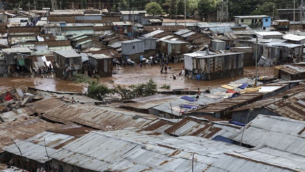
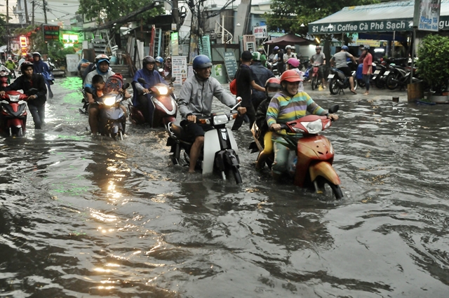
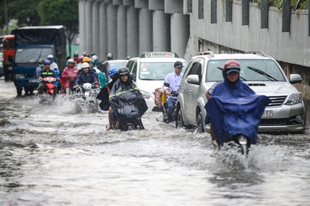
| HCM City's new drainage water plan will take into account the city’s expansion and the impact of climate change, erosion and rising sea levels. – VNA/VNS Photo Hồng Giang |
HCM CITY – A plan for a new water-drainage network in HCM City has been submitted to the Prime Minister for approval.
The city has been using a water drainage plan approved in 2001 that covers the central area of about 650sq.km, which represents about 30 per cent of the city's total area. The plan does not account for the impact of climate change, rising water levels and erosion.
Without a comprehensive overhaul of the drainage network over the next 10 years, the city would have to spend trillions of đồng, so a new plan is essential, according to the ministry.
The new plan covers three times the area of the old plan, or about 2,100sq.km. It also includes studies of nearby provinces such as Đồng Nai and Bình Dương.
Đặng Phú Thành, deputy chairman of the city’s Department of Construction, said that if the plan is approved, the city would refine the plan over the next nine months. Factors such as surface water, land and existing wastewater treatment plans will be considered.
The department is working with consultancy experts from Denmark and Japan on the drainage plan. Funding for the plan will come from the World Bank loans.
Dr Vũ Ngọc Long, chairman of the Việt Nam Institute of Ecology’s scientific council, noted that HCM City is surrounded by Sài Gòn, Đồng Nai and Vàm Cỏ rivers and has thousands of canals, ponds and lakes of various sizes.
Millions of square metres of lakes, ponds and canals have been buried to create land for development. For the water drainage plan to work effectively, the city needs to dredge existing canals to improve water flow and reopen as many buried canals as possible.
Architect Lê Thành Khái from the HCM City University of Architecture said the city should avoid filling future canals and have more detention basins between residential areas to reduce flooding.
The newly established Thủ Đức City area is expected to have 10 per cent of its land as parks, and 30 per cent of them will have detention basins, according to the city's Department of Construction.
Because of heavy rains, land subsidence and high tides on the Sài Gòn and Đồng Nai rivers, HCM City suffers from heavy floods every year.
According to the Ministry of Natural Resources and Environment, the city’s rivers could rise by about 30cm by 2050 and 75cm by the end of the 21st century. – VNS
Environment
 Environment
 Environment
 Environment
 Environment
 Environment
 Environment
 Environment
Vietnamese and foreign experts and scientists gathered at a conference in Cần Thơ City on Wednesday to seek solutions to boost sustainable development in the Mekong Delta region amid climate change.
 Environment
 Environment
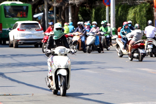
With the onset of a heat wave in HCM City, doctors are urging people to take preventive measures against heat-related health conditions.
 Environment
The Ministry of Construction has submitted to the Government for approval plans to triple the length of HCM City’s drainage network.
 Environment
 Environment
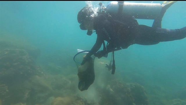
Coral reefs off Chàm Island have been well conserved with an average coverage of 59.16 per cent at seven sites following an annual reef check and coral clean-up programme.
 Environment
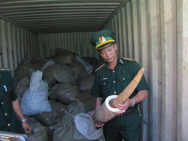
A survey of nearly 600 Chinese tourists who visited Việt Nam showed that 17 per cent of them visited ivory shops during their visit and an estimation 2 per cent bought ivory products with an average spending of VNĐ12 million (US$522).
 Environment