 Features

Seared Hokkaido Scallop with Plum Honey Vinaigrette
1.
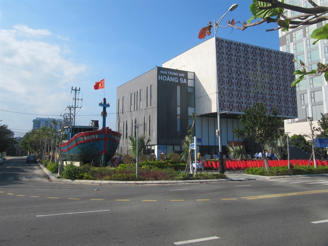
Hoàng Sa Museum, on the coast of Sơn Trà peninsula, Ðà Nẵng City, is a unique site preserving documents and other artefacts on Việt Nam’s sovereignty over the Hoàng Sa (Paracel) and Trường Sa (Spratly) archipelagos.
|
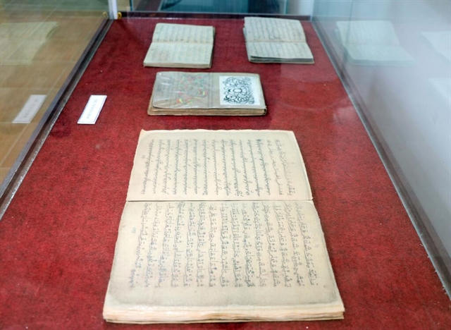
| Hoàng Sa Museum in Đà Nẵng keeps and exhibits over 400 documents, photos and ancient maps of the Hoàng Sa Islands of Việt Nam. All the maps clearly show the southernmost point of China stops at Hainan Island. VNS Photo Công Thành |
The Hoàng Sa Museum, on the coast of Sơn Trà peninsula, Ðà Nẵng City, is a unique site preserving documents and other artefacts about Việt Nam’s sovereignty over the Hoàng Sa (Paracel) and Trường Sa (Spratly) archipelagos.
The museum displays over 400 maps, documents and photos, of which 150 are ancient maps showing the country’s sovereignty over the two archipelagos from the 16th to 19th century.
Between 2012 and 2014, Vietnamese-American engineer Trần Thắng collected many old maps and atlases showing clear historical evidence that the southernmost part of China is Hainan Island, and the Hoàng Sa and Trường Sa islands belong to Việt Nam.
|
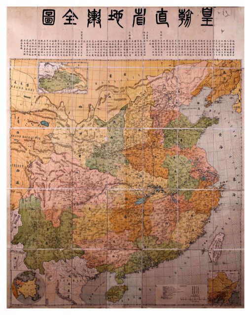
| A map published in 1904 by the Qing Dynasty of China, showing Hainan Island is the southernmost border of China. It does not include Hoàng Sa and Trường Sa islands. Photo courtesy of Hoàng Sa Museum |
Thắng, an aerospace engineer at Pratt & Whitney, the US, said he had not known about the Hoàng Sa Islands maps until 2012 when Dr Mai Ngọc Hồng from the Han-Nôm Institute in Hà Nội, donated an old map published in 1904 by the Qing Dynasty, to the Museum of History of Việt Nam. The map clearly indicated the southernmost boundary of China is Hainan Island.
Thắng, born in Quảng Ngãi Province, said the Chinese Qing Dynasty's map motivated him to collect old maps related to Việt Nam’s sovereignty over Hoàng Sa and Trường Sa islands. He has since collected vast old maps about China and Annam (an old name of Việt Nam).
“It’s amazing. I bought an old China atlas in New York in 2012. It was printed in 1933 and published by the Directorate General of Posts, the Ministry of Transportation of the Republic of China. It lists names of 29 official provinces of China, but does not refer to the Paracel and Spratly islands," Thắng said.
"The map of the coastal, southeast province of Guangdong, indicates that Hainan Island is the most southerly point of China.
|
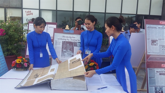
| An atlas of Hoàng Sa is open for public visits at Hoàng Sa Museum in Đà Nẵng. At least 150 ancient maps clearly show the two archipelagos of Hoàng Sa and Trường Sa are under Việt Nam's sovereignty. VNS Photo Công Thành |
“During 2012 to 2014, I collected 150 old maps, of which 80 are Chinese maps showing the southernmost frontier of China is Hainan Island, and 50 indicating that the Paracels belongs to Việt Nam.”
He has since donated the complete map collection to Đà Nẵng City.
Thắng, president of the Institute for Vietnamese Culture and Education in New York, said the most added to the collection recently was the Pattie de la Conchinchine, an 1827 map printed in the six-volume World Atlas by late Belgian cartographer Phillippe Vandermaelen.
He said the Pattie de la Conchinchine map indicated the central region was part of Annam (a French protectorate encompassing the central region of Việt Nam), and the Paracel islands were under the sovereignty of Việt Nam from at least the 19th century onwards.
“The Pattie de la Conchinchine was a rare map printed early in the 19th century in great precision, using western written names of the islands in the Paracels,” he added.
The map, drawn by Philippe Vandermaelen, founder of the Belgium Royal Geographical Society, indicates that the central coast of Việt Nam stretches from the 12th parallel (now Khánh Hòa Province) to the 16th parallel (now Quảng Nam Province).
The map also shows the Paracel Islands between the 14th and 17th latitudes, and from the 109th to 113th longitudes.
Võ Ngọc Đồng, chairman of the Hoàng Sa Island District, said the map was a highly precious document proving Việt Nam's sovereignty over the islands.
“It’s a treasure for Việt Nam. The map will enrich the store of documents and other artefacts related to the history of Hoàng Sa Islands, and facilitate further studies of Việt Nam’s islands,” Đồng said.
The chairman said a textbook on Việt Nam’s sovereignty over the two archipelagos was included in the curriculum at junior secondary and high-school.
Historical data
The Hoàng Sa Museum was inspired by the design of a royal seal from the Nguyễn Dynasty’s King Minh Mạng in 1835 for establishing the Hoàng Sa Flotilla to administer the islands.
It was a stamp of authority for Việt Nam’s sovereignty over the Hoàng Sa and Trường Sa islands, recorded in documents from previous centuries.
The islands were clearly described in detail on ancient maps and books from the Lý and Nguyễn dynasties between the 11th and 19th centuries, according to Huỳnh Thị Kim Lập from the museum.
|
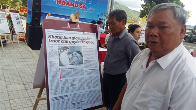
| Nguyễn Đình Rê visits an exhibition at Hoàng Sa Museum. He was dispatched by the Sài Gòn administration to protect the Paracels in 1974. VNS Photo |
Lập said the Hồng Đức map collection was perfectly compiled integrating the mainland, seas and islands of Đại Việt (Great Việt) under the reign of King Lê Thánh Tông in 1490.
Lập said the ancient books of Việt Nam, Toàn Tập Thiên Nam Tự Chí Lộ đồ thư (Route Maps from the Capital to Four Directions), drawn by Đỗ Bá in 1686, gave ample of evidence of Việt Nam's sovereignty over Hoàng Sa and Trường Sa islands.
According to historical documents stored at the museum, a group of islands east of the Paracels was illegally occupied by the Chinese troops in 1956, while the Geneva Peace Agreement was signed in 1954, separating Việt Nam into two parts at the 17th parallel (in the middle of the Bến Hải River in Quảng Trị Province).
Moreover in January 1974, China took the rest of the Paracels by force, and has since illegally occupied the islands. VNS

|
| Đà Năng high school students join a flag-raising ceremony at Hoàng Sa Museum. It keeps precious ancient maps, documents and photos, showing clear evidence of Viêt Nam's sovereignty over the Hoàng Sa and Trường Sa islands. Photo courtesy of Hoàng Sa Museum |
Features
 Features
 Features
 Features
 Features
 Features
 Features
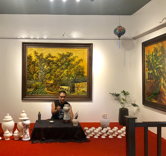
Fed up with social distancing, a young man from Hải Dương Province has channelled his creativity by getting into crafts to alleviate the dull tedium that comes with lockdown life.
 Features
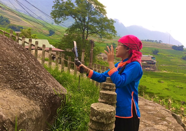
Though Sa Pa District in the northern province of Lào Cai has long lured tourists all-year-round due to its mild temperature, spectacular mountains, beautiful forest and unique ethnic minority groups, social distancing has now made people stay at home. However, two innovative Sa Pa locals are now offering online tours of the classic Việt Nam destination.
 Features
The COVID pandemic means many young artists throughout the nation have had to put their careers on hold
 Features
City dwellers throughout the country have got used to social distancing and days of struggle. Many have found new ways to entertain themselves and even to grow their own vegetables.
 Features
The optimism and determination of people with disabilities have inspired a 22-year-old student in Hà Nội to create photos capturing their inner beauty
 Features
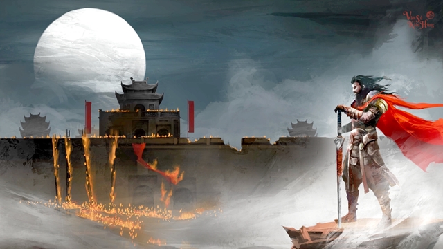
An animation entitled Bình Ngô Đại Chiến (The Pacification of the Wu) by a team known as Đuốc Mồi has received 5 million views within a few months of release.
 Features
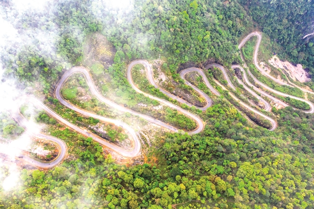
The 14-section Mẻ Pia Pass in Cao Bằng has attracted much attention. It is considered the most dangerous pass in the northeast, and is a surefire bet for adrenalin-junkies feeling adventurous.
 Features
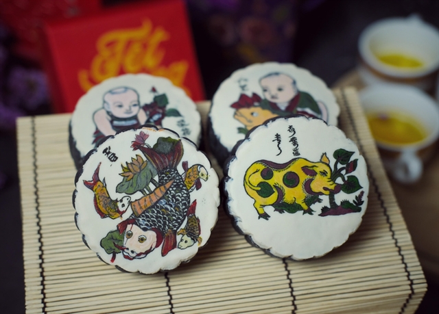
During a widespread and intense lockdown, many people feel their days are longer and they do not have enough to do, but baker Nguyễn Thị Thùy Dương is buried in work.
.jpg) Features
Features
To commemorate 100th anniversary of poet Quang Dũng (1921-2021) Phạm Hà puts his most known poem into perspectives