 |
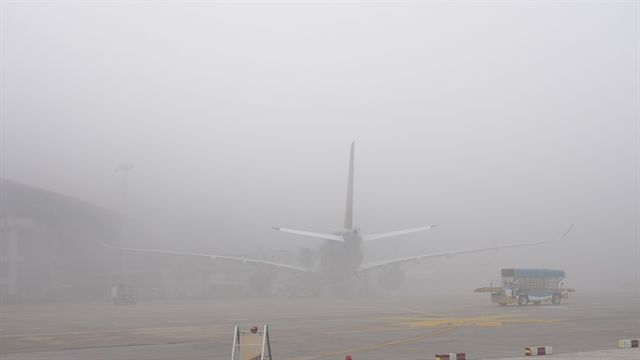
| A corner of Hoàn Kiếm Lake in Hà Nội in foggy weather. VNA/VNS Photo Tuấn Anh |
HÀ NỘI — The National Centre for Hydro-Meteorological Forecasting predicted that the northern region would experience frequent foggy days from now until March 10 due to the eastward shift of the continental cold high-pressure system.
The centre indicated that during this forecast period, cold air will continue to influence Việt Nam’s weather, potentially bringing scattered showers and thunderstorms on certain days.
Notably, on the mainland, the eastward-shifting and modified cold air mass may result in prolonged drizzles, light rain and fog, particularly affecting the northeastern and north-central provinces. This could impact daily activities and transportation.
Additionally, under these weather conditions, strong winds and high waves are expected, posing challenges for maritime activities.
Nguyễn Đức Hòa, Deputy Head of the Climate Forecasting Department at the National Centre for Hydro-Meteorological Forecasting, noted that the equatorial trough is strengthening and shifting northward. This could impact the southern part of the East Sea and potentially affect the southern region.
In the central and southern regions, scattered showers and thunderstorms may occur on some days.
Rainfall in the northern and north-central regions is expected to be around the long-term average, while other areas may see an increase of 10–20mm, with some locations exceeding 30mm compared to the average for this period. —VNS
 Environment