 Society
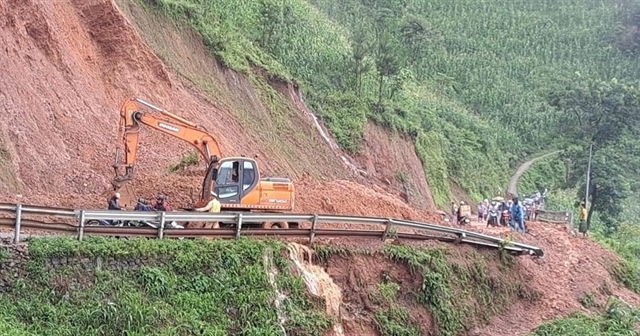
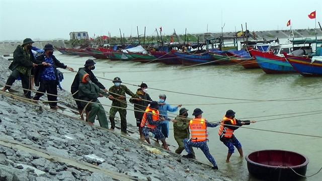
Flash floods and landslides warning for northern Việt Nam
Hà Nội City is forecast to experience similar conditions to the northwest region, with temperatures ranging from 26°C to 34°C.
 |
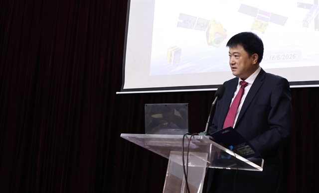
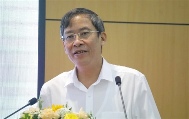
| Dr. Trịnh Hải Sơn, Director of the Institute of Geosciences and Mineral Resources. —Photo baotainguyenmoitruong.vn |
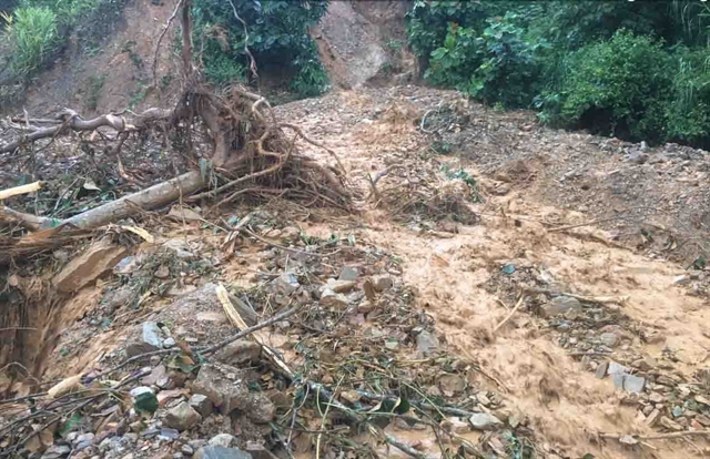
Experts predict that in this rainy season many provinces and cities will suffer from flash floods and landslides.
Dr. Trịnh Hải Sơn, Director of the Institute of Geosciences and Mineral Resources spoke to Tài nguyên & Môi trường (Natural Resources & Environment) newspaper about research into natural disasters and how they might be prevented.
What is the most recent research on the risks of flash floods and landslides in Việt Nam?
Various organisations, including those within and outside the Ministry of Natural Resources and Environment (MoNRE), have conducted extensive research on landslides, rockfalls, debris flows, flash floods and mudslides in Việt Nam. Studies have focused on investigating, surveying and zoning, and issuing warnings for potential flash floods in mountainous regions.
Pilot systems for early landslide warnings, such as those in Tương Dương District, Nghệ An Province, have been implemented.
Assessments and zoning for landslide risks in mountainous areas, along with the development of technologies to assess risks along major transport routes, are being carried out.
Efforts also include installing early warning systems for flash floods in the Peng River basin, Bát Xát District, Lào Cai Province, and deploying landslide warning devices in Xín Mần District, Hà Giang Province. Studies in Quảng Nam Province are examining landslide risk forecasts to propose responsive solutions.
Additionally, there are initiatives to develop real-time early warning systems for debris flows and landslides in mountainous regions, establish scientific criteria for identifying vulnerable areas and implement zoning and rainfall threshold models for landslides and flash floods.
Projects are underway to design and deploy real-time monitoring systems for early landslide, rockfall, debris flow and flash flood warnings across Việt Nam’s mountainous and midland areas.
A significant focus is on creating a unified database for early warning systems and implementing zoning projects to map natural disaster risks, including flash floods, landslides and rain-induced subsidence in midland and mountainous regions.
These efforts have resulted in the development of effective research methodologies, identification of critical rainfall thresholds and the establishment of multi-level early warning systems and comprehensive risk zoning maps.
In your opinion, what are the existing shortcomings and limitations in the research on flash floods and landslides in Việt Nam?
In reality, only a few early warning stations for landslides, rockfalls, debris flows, flash floods and mudslides in Việt Nam provide accurate warnings. Several limitations are from a lack of equipment to measure the input parameters needed to forecast these events. Most warning stations are only equipped with rain gauges, which do not provide enough data to accurately predict the processes and likelihood of these disasters.
In some cases, the early warning systems for these hazards lack real-time data processing capabilities. Landslides, rockfalls, debris flows and flash floods often occur under adverse weather conditions, such as heavy or prolonged rainfall, which hampers the real-time transmission of measured data. This can result in issues like internet outages, power failures and lack of 3G connectivity.
Moreover, research and development of equipment for early warning stations in Việt Nam are limited. Most of the equipment, such as rain gauges and water level meters, are imported, with only a few being domestically manufactured. Consequently, there are significant challenges in mastering the technology and building a large, interconnected database among units within and outside MoNRE.
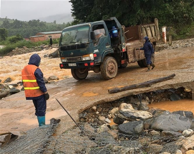
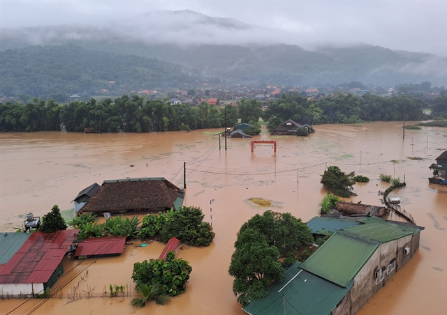 |
| Heavy rain caused widespread flooding in various areas of Hà Giang Province on June 10. — VNA/VNS Photo |
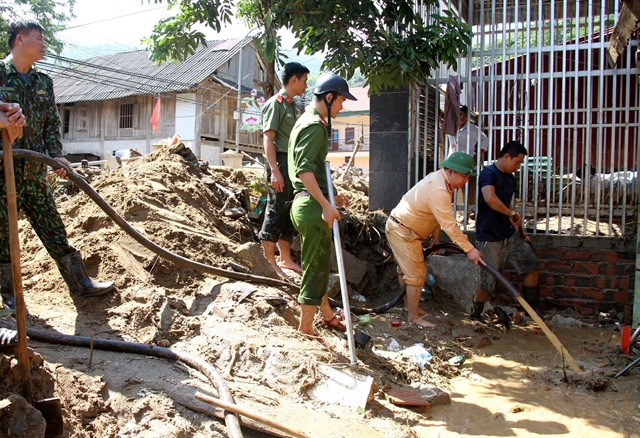
Despite previous lessons, many regions continue to be passive in forecasting and responding to natural disasters such as flash floods and landslides, resulting in significant human and economic losses. What strategies does the Institute of Geosciences and Mineral Resources propose to improve the effectiveness of warnings in Việt Nam?
Landslides, debris flows, flash floods and mudslides pose severe risks, causing substantial casualties and property damage with enduring impacts. These hazards are increasingly frequent, intense and expansive amidst climate change, exhibiting more erratic, extreme and unpredictable patterns.
Factors like rapid socio-economic growth, infrastructure expansion, environmental degradation, and vegetation decline further heighten these risks. Currently, Việt Nam's capabilities for monitoring and early warning systems are inadequate, exacerbated by outdated communication infrastructure prone to disruptions during severe weather.
Thus, prioritising research and deploying monitoring and early warning equipment in high-risk areas is crucial. Integrating data from centralised and local early warning stations is essential for comprehensive coverage.
There is a need to focus on designing and locally manufacturing sensor equipment tailored to Việt Nam's conditions for landslide, debris flow, flash flood and mudslide warnings, ensuring cost-effective production, maintenance and repair.
Furthermore, enhancing international cooperation in research and technology transfer for designing and manufacturing early warning station equipment suited to Việt Nam's environment is essential for improving disaster preparedness. — VNS
Society
 Environment
 Society
 Opinion
 Society
 Opinion
 Opinion
 Opinion
 Opinion
 Opinion
 Opinion
 Opinion
 Opinion
 Opinion
.jpg) Opinion
Opinion
 Opinion
 Opinion
 Opinion
 Opinion
 Opinion