 Environment
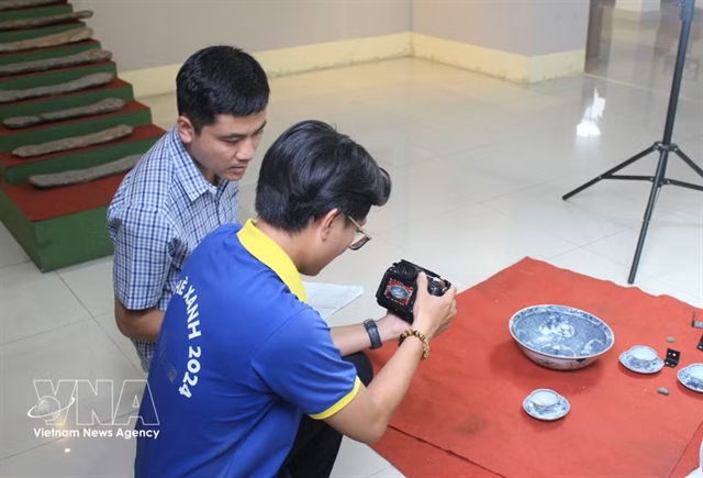
Virtual museums bring Lâm Đồng's heritage into digital age
1.
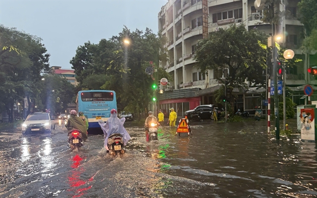 |
| The Lý Thường Kiệt–Phan Bội Châu intersection in Hà Nội flooded after torrential rain on July 19. — VNA/VNS Photo Quốc Khánh |
HÀ NỘI — Forecasting urban flooding remains a major challenge due to multiple complex factors, including real-time rainfall monitoring and flood mapping, experts have said.
Speaking to Voice of Vietnam (VOV), National Centre for Hydrometeorological Forecasting (NCHMF) Deputy Director Hoàng Văn Đại said that urban flooding occurs frequently during the rainy season.
The cause of the phenomenon can be attributed to multiple factors, including heavy rainfall, downstream river flooding, reservoir discharges, tidal surges or a combination of these elements.
“In the context of climate change, cities will have to gradually adapt to increasingly frequent floods,” he said.
“However, damage can be mitigated with proactive responses such as heavy rain warnings, and by upgrading and building better drainage systems.”
Today, flood maps for major river basins across Việt Nam have been developed by the national hydrometeorological forecasting system.
Several provincial and municipal hydrometeorological stations have also taken proactive steps to update local flood maps, mainly for flooding hotspots in the central region.
However, creating urban flooding forecasts is highly complex and requires two crucial factors: real-time rainfall monitoring and flood mapping.
Đại explained: “The challenge is that the current national forecasting system cannot yet meet the station density required.”
Input data for modelling must also be synchronised, integrating national monitoring networks with local specialised monitoring data and weather radar to enable short-term rain forecasting between 30 minutes and one hour in advance, he noted.
“Flood maps must be modelled and simulated based on detailed urban topography, including residential areas and full information on the drainage system. Then, flood scenarios are developed using varying parameters such as rainfall volume, drainage capacity and river water levels.
“This data is processed to provide timely alerts that reflect real-time rainfall and flooding situations. These efforts require close cooperation between local authorities and specialised departments with forecasting agencies,” he said.
In recent years, the NCHMF has piloted flood warnings for Hà Nội’s inner areas with support from Belgium. The system uses Flood4Cast technology, integrating real-time rainfall monitoring with flood warnings.
Based on the same technology, another project has been launched to build a risk management platform for the impact of extreme rainfall on the Vu Gia–Thu Bồn river basin in Đà Nẵng City.
The agency is also testing a system that can issue detailed warnings for flood-prone traffic routes and define the possible area, intensity and duration of flooding.
Through the end of 2025, a comprehensive database will be built by collecting information on historic floods caused by storms, river water level surges and heavy rain in the past 10 years; radar and ground-based rainfall data; hydrological data on river flows and sea levels; GIS data on topography, river systems, drainage infrastructure, housing and public works; and flood damage records.
This data will serve not only as inputs for forecasting models but also for validating, refining and updating systems in real time.
Flood maps will be created using satellite images of actual flooding, combined with simulations of urban inundation and river flooding.
After the first flood map is developed, the project will expand the forecasting model and produce flood maps in the next year based on climate scenarios and economic damage modelling.
“By 2027, we expect to complete a map of economic risks from extreme rainfall. This will form the basis for flood scenario simulation corresponding to different levels of heavy rain, overloaded drainage systems or abnormal rises in river or tidal levels,” said Đại.
Using this data, forecasts can be transformed into concrete, timely and effective response decisions, said the hydrometeorological agency deputy director.
Authorities can take proactive measures for evacuations, infrastructure reinforcement and early warnings to citizens and businesses, therefore reducing property damage and disruption in their daily activities.
According to the Department of Dike Management and Natural Disaster Prevention and Control, the development of a risk management platform for extreme rainfall impacts is a technical effort that aims to transform risk governance practices, promoting the digital transformation in Việt Nam’s disaster prevention sector. — VNS
Environment
 Environment
 Environment
 Environment
 Environment
 Environment
 Environment
 Environment
 Environment
 Environment
 Environment
 Environment
 Environment
 Environment
 Environment