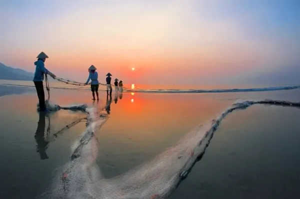
 Travel

Over 300 firms participate in Vietnam Medi-Pharm Expo 2026
1.
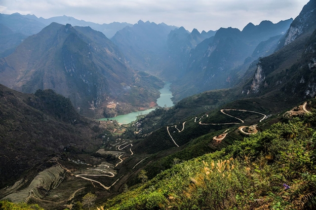 |
| With 50 sharp turns, Tà Làng Pass is known as the most dangerous pass in Hà Giang. — Photo mia.vn |
By Lâm Giang
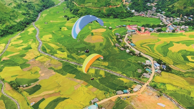
The northern province of Hà Giang is the land of mountain passes. Among these passes, Tà Làng is the most popular with tourists as at the end they find beautiful Nho Quế River.
Located at an altitude of nearly 1,500m down to the edge of the Nho Quế River, Tà Làng Pass is a 45-step pass with 50 sharp turns. It has a length of nearly 8km and is known as the most dangerous pass in the mountainous area.
To get here, from Hà Giang City, we take the route of Đồng Văn Town - Mèo Vạc - Mã Pì Lèng Pass - Tà Lang.
Arriving at Tà Làng Village, Pải Lủng Commune, Mèo Vạc District, the towering limestone mountains appear with wild beauty. Clouds and mountainous mist spread everywhere, embracing the towering peaks. Below, the Nho Quế River bends and wriggles among the limestone mountains.
Looking down from the stop on Highway 4C, there is a zigzag road with dozens of challenging turns. This is Tà Làng Pass.
We rented motorbike taxis driven by local people because they know the way at a price of VNĐ150,000 for the round trip. This pass is very narrow, only wide enough for two motorbikes to move so we go very carefully.
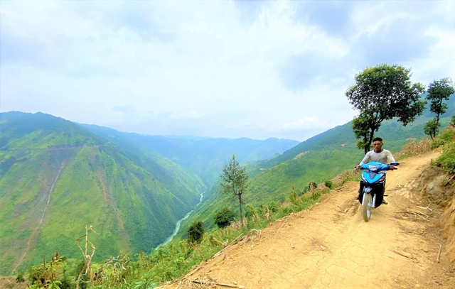 |
| The road in Tà Làng Pass is very narrow, only enough for two motorbikes to move. — Photo discoverhagiang.com |
Although we have travelled many steep passes in the northwest to the northeast, this 8km road is indeed a challenge for us. During the journey, we rode motorbikes with one side of a cliff standing imposingly in the sun and wind, and on the other side a deep abyss that never sees the bottom. Many of the bends here have a very steep slope. There are sharp turns so drivers have to use the foot brake and handbrake continuously.
Many times when we were sitting behind on the motorbikes, we were so nervous, so we asked to stop to breathe and calm down as well as to enjoy fresh air, admiring the beautiful scenery of the mountains and rivers. Stopping on the route, we could also see the idyllic scene of ethnic Giáy and Mông people cultivating the terraced rice fields.
Standing from the highest point at Tà Làng Pass, we had a panoramic view of the wilderness and majesty of the northeast mountains with undulating peaks and the Nho Quế River hidden in the fog clouds. In the distance were small houses among the green trees.
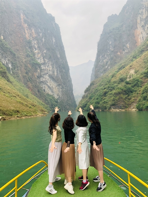 |
| Visitors take pictures on the Nho Quế River. — Photo dongvangeopark.com |
After about 45 minutes of overcoming the turns, we reached the marina to explore the Nho Quế River, which has been honoured as one of the unique tectonic valleys of Việt Nam by the Ministry of Culture, Sports and Tourism. The scene unfolded spectacularly to everyone's delight. The cool breeze blowing from the water made us forget the heat.
The section of the Nho Quế River near the wharf is quite wide with waves crashing against the side of the boat. Here the scenery of heaven and earth appears immense with the two sides being terraced fields. In many places, the terraced fields run from the river's edge to the top of the limestone mountain. Land here is very rare so wherever there is land, there will be crop fields and gardens.
There are many types of boats of indigenous people for guests to choose. If travelling in large groups, there will be large metal boats with roofs, life jackets and full rescue gear. If travelling in small groups or couples, visitors can rent a small boat without a roof, or hire people to row bamboo rafts or row themselves to explore the river.
After about 20 minutes of cruising on the river, the boat carrying us began to slowly move towards the section of the river flowing through the Tu Sản Canyon. The Nho Quế originates from China and flows in a northwest - southeast direction through many gorges. But the section of river flowing through Tu Sản Canyon is considered to be the most magnificent and impressive.
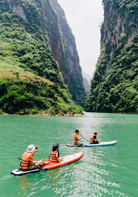 |
| Kayaking on the Nho Quế River. — Photo datviettour.com.vn |
Tu Sản Canyon is the magic of creation over millions of years. With a cliff height of up to 700–800m and a length of about 1.7km, it is considered a geomorphological marvel, as well as an archaeological, stratigraphic, and environmental marvel. It was discovered in the area of the three communes of Pải Lủng, Pả Vi and Xín Cái of Mèo Vạc District.
Seen from a distance, two limestone mountain ranges rise up to form a giant V shaped cliffs. They stand close together, forming a very narrow canyon for river water to flow through. The boat carrying us parted the water to go in the middle of Tu Sản Canyon. The steep cliffs on both sides with green vegetation appeared to our extreme excitement.
The boat was floating in the middle of Tu Sản Canyon, the feeling of coolness enveloped everyone along with the chirping of birds, creating a special and indescribable impression. The boatman said that before, the water level of the Nho Quế River was often low, so it was very difficult to get into Tu Sản Canyon by boat. But since the opening of the Nho Quế River Hydropower Plant, the water has risen, so it's easier for boats to pass through to Tu Sản Canyon.
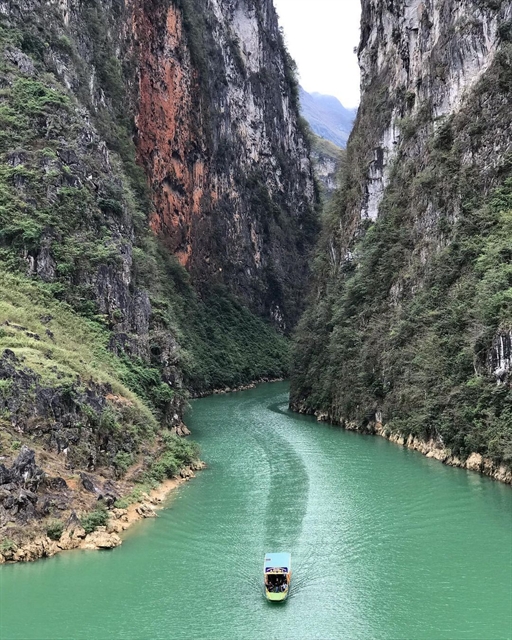 |
| Tu Sản Canyon is the magic of creation of millions of years. — Photo ximgo.com |
In the journey to discover Hà Giang, if you want to enjoy the satisfying feeling of being the master of heaven and earth, enjoying nature and breaking all your limits, then try once to experience Tà Làng Pass to admire the beautiful Nho Quế River and the majestic Tu Sản Canyon. VNS
Travel
 Travel
 Travel
 Travel
 Travel
 Travel
 Travel
 Travel
 Travel
 Travel
 Travel
 Travel
 Travel
 Travel
 Travel