 |
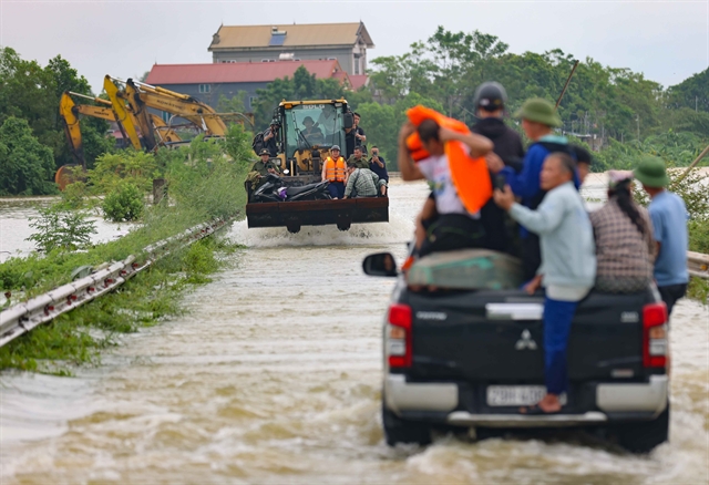
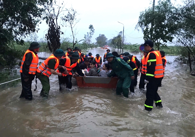
| Armed forces evacuate people of Phú Cường Commune, in Hưng Yên Province to a safe place.—VNA/VNS Photo |
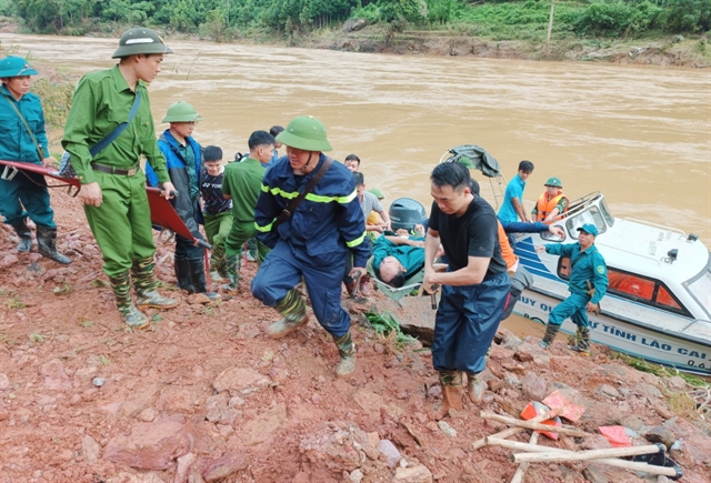
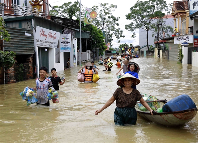
HÀ NỘI — Typhoon Yagi, and the floods and landslidesin the aftermath has killed 197 people while 128 people remain missing as of 7am on Thursday.
The data was revealed by the Việt Nam Disaster and Dyke Management Authority under the Ministry of Agriculture and Rural Development.
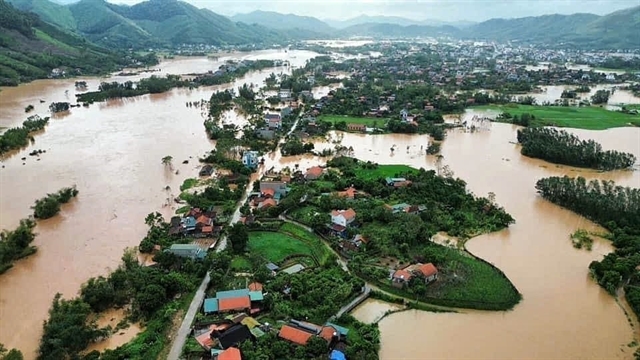
The disaster has also caused significant damage to infrastructure, with 130,268 houses reported as damaged and 57,857 homes submerged.
In the agricultural sector, the typhoon has led to extensive damages including 195,929ha of rice paddies have been flooded and damaged; 35,010ha of other crops have been flooded and affected; 22,237 hectares of fruit trees have suffered damage; 1,791 aquaculture cages have been destroyed or swept away; 2,502 livestock and over 1.5 million poultry have perished.
According to the forecast bulletin from the National Centre for Hydro-Meteorological Forecasting at 9am on Thursday morning, water levels are fluctuating around the peak flood level of 7.63m, which is 1.33m above the Level 3 warning threshold, but 0.21m below the historic flood level of 7.84m from 1971 in Cầu River in Bắc Ninh Province.
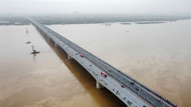 |
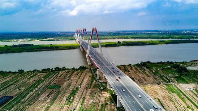
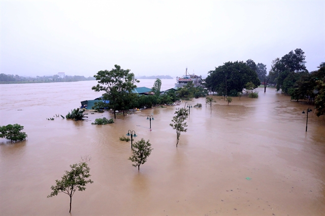
| The Red River water level is 30cm below the Level 3 flood warning at 8am on Thursday.—VNA/VNS Photo Hoàng Hiếu |
Water levels are fluctuating around the peak flood level of 7.23m, which is 0.93m above the Level 3 warning threshold, and 0.30m below the historic flood level of 7.53m from 1986 in Thương River in Bắc Giang Province.
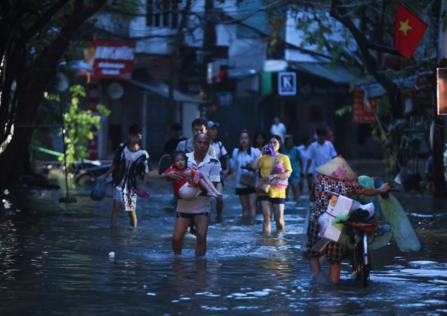
High flood levels may cause inundation in low-lying areas along the river, breach and overflow of river embankments, and severe erosion of dykes and riverbanks, posing a serious threat to vulnerable areas in Hà Nội City, Hà Nam, Nam Định, Hải Dương, Hưng Yên, Thái Bình and Ninh Bình provinces.
Flooding may occur in low-lying areas along the rivers in Lạng Sơn, Cao Bằng, Lào Cai, Yên Bái, Bắc Giang, Bắc Kạn, Thái Nguyên and Hòa Bình provinces.
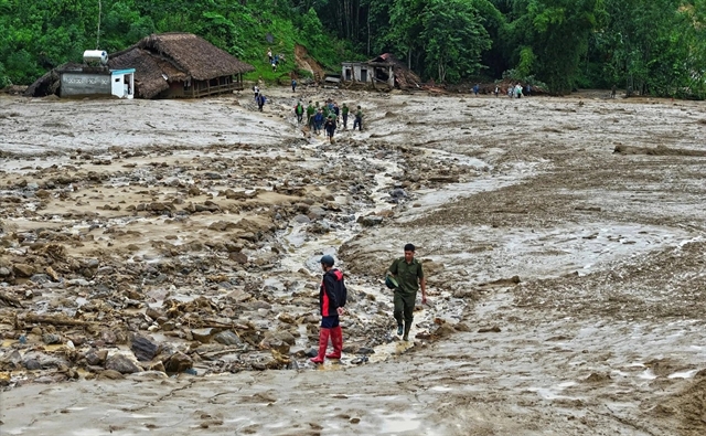
There is also a risk of flash floods and landslides on steep slopes in the mountainous regions of northern Việt Nam.
Real-time updates and alerts for flash floods and landslides are available on the National Centre for Hydro-Meteorological Forecasting’s website: http://luquetsatlo.nchmf.gov.vn/ and in separate flash flood and landslide warnings.
Level 1 warning means potential flood risk, indicated by rising water levels in rivers and streams, beginning to cause inundation in low-lying areas and threatening higher ground.
Level 2 warning means Dangerous flood conditions, with rising water levels causing flooding in flat areas except for protected towns and cities; fast-flowing rivers posing risks to riverbanks and causing erosion of embankments; bridge foundations at risk due to erosion.
Level 3 warning means severe flood conditions, with very high water levels flooding all low-lying areas, including urban zones; embankment safety severely threatened; infrastructure damage beginning to occur.— VNS
 Society

.jpg)