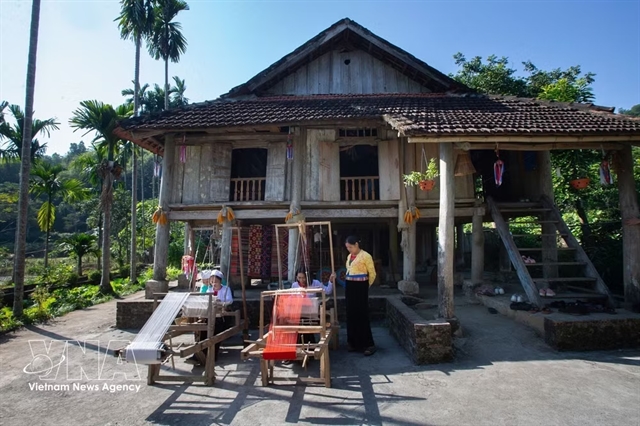
 Society


BM Windows launches one of Southeast Asia's largest LEED Gold-certified factories
1.
A tropical depression is forming and heading for the East Sea tomorrow afternoon, according to the National Centre for Hydro-meteorological Forecasting (NCHMF).
 |
| A cold spell hit many parts of the northern and north-central regions early today and may last for a week. This file photo shows local residents bundled up against the cold weather in Hà Nội.—VNA/VNS Photo Danh Lam |
HÀ NỘI — A tropical depression is forming and heading for the East Sea tomorrow afternoon, according to the National Centre for Hydro-meteorological Forecasting (NCHMF).
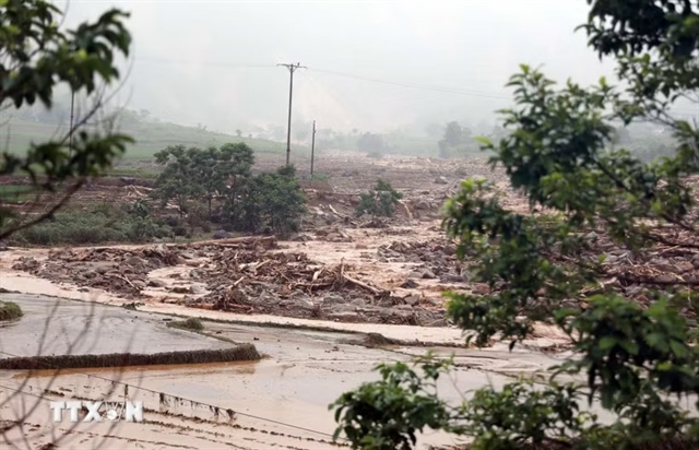
From today until December 31, floods may occur at rivers between Thừa Thiên – Huế and Khánh Hoà provinces, with water levels in small rivers reaching alert level two. Low-lying and urban regions stretching from Quảng Bình to Khánh Hoà may suffer flashfloods and landslides.
Yesterday evening, the system was located some 340 kilometres southeast of central coastal areas of the Philippines, with strong winds moving at 50-60 kilometres per hour and gusting at level nine.
As of 7pm tomorrow, the tropical depression may move west-northwest, at 15-20 kilometres per hour, packing gale-force winds. It will then move westward late on December 30, entering the East Sea and probably strengthening into a storm, at alert level three. It is expected to hit southern Việt Nam.
Strong winds are forecast out at sea, triggered by cold air masses. In the Tonkin Gulf and the northern East Sea, northeastern winds may strengthen to level seven, causing rough seas. The northeasterly wind will also blow strongly in coastal areas in the central and southern regions.
A cold spell hit many parts of the northern and north-central regions early today, and is expected to last a week, possibly causing sleet in the northern highlands. It may be the most extreme cold spell seen over the past decade.
Trần Quang Năng, head of the Weather Forecast Division at NCHF, said yesterday that the northern midland and mountainous region was the first place to experience the strong cold spell, along with medium to heavy rain.
Năng noted the cold spell will likely intensify on December 29 and 30, with temperatures dipping sharply. During these two days, the temperature in the provinces of the Northern Delta may fall to 8-11 degrees Celsius, while the mountainous regions will suffer very cold weather as low as 4-7 degrees Celsius, or even lower than 3 degrees Celsius at higher altitudes.
The cold spell may trigger frost and sleet in the northern mountainous areas during the coming two days.
The cold weather will impact the daily activities of local residents, especially those living in the mountainous and midland areas. People are advised to take extra steps to stay warm during the coming days.
As for the agriculture sector, Năng said farmers should adopt preventive measures to minimise the impact on plants and animals.
In Hà Nội, the temperature may plummet this weekend to lower than 10 degrees Celsius, accompanied by torrential rain. Meanwhile, heavy downpours may appear in the central coastal city of Đà Nẵng.
Rain and thunderstorms are in the forecast for HCM City in the next three days, after which the rainfall will reduce. — VNS
Society
 Society
 Society
 Society
 Society
 Society
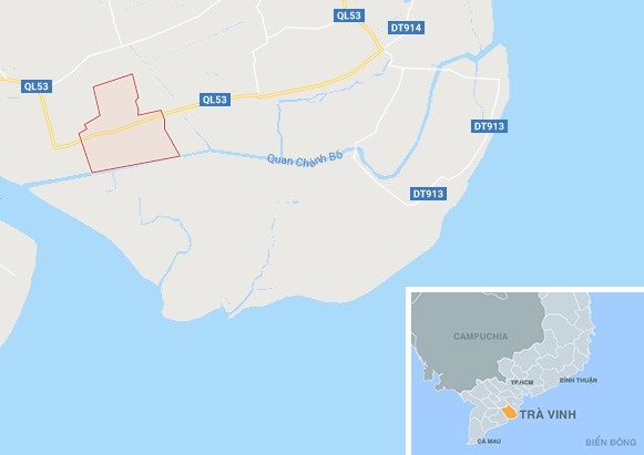
Four workers at Duyên Hải Thermal Power Plant in the Mekong Delta province of Tra Vinh died of gas suffocation yesterday.
 Society
The Ministry of Education and Training yesterday unveiled a new general educational curriculum which aims to reduce pressure on students and allow them to choose subjects they enjoy.
 Society
The Investigation Police Agency under the Ministry of Public Security said on Friday that it has started criminal proceedings against 10 defendants, including former General Director of the Đông Á Bank (DAB) Trần Phương Bình and former DAB Deputy General Director Nguyễn Thị Ngọc Vân.
 Society
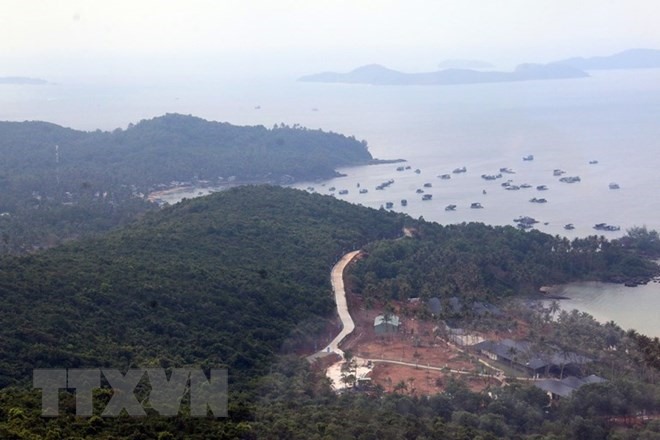
A oyster breeding project in the Mekong Delta province of Kiên Giang which is part of larger effort to preserve and regenerate natural aquatic resources on Phú Quốc Island has seen positive results, according to Phú Quốc Reserve’s management board.
 Society
Some 200 young academics, professionals and others have volunteered for community programmes organised by the HCM City unit of the Hồ Chí Minh Communist Youth Union, benefiting more than 13,150 people in the city and its neighbouring provinces.
 Society
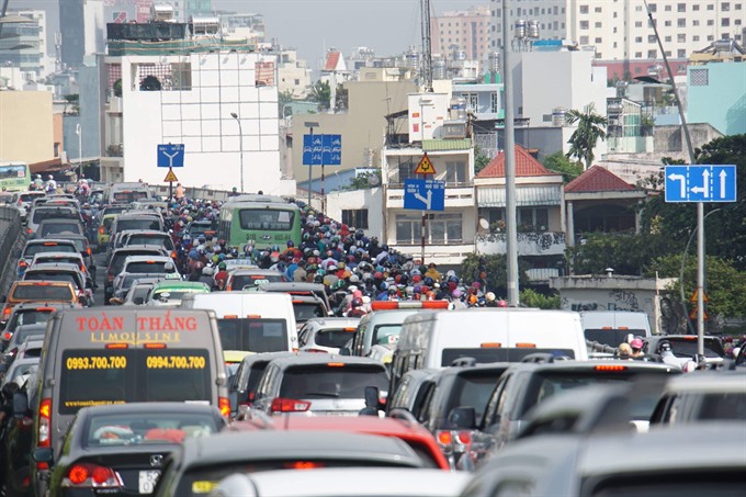
The HCM City Department of Transport has added more patrols to handle traffic congestion during the holiday season.
 Society
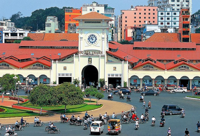
Despites difficulties and challenges the HCM City economy grew by 8.3 per cent this year to more than VNĐ1.33 trillion (US$59.6 billion).
 Society
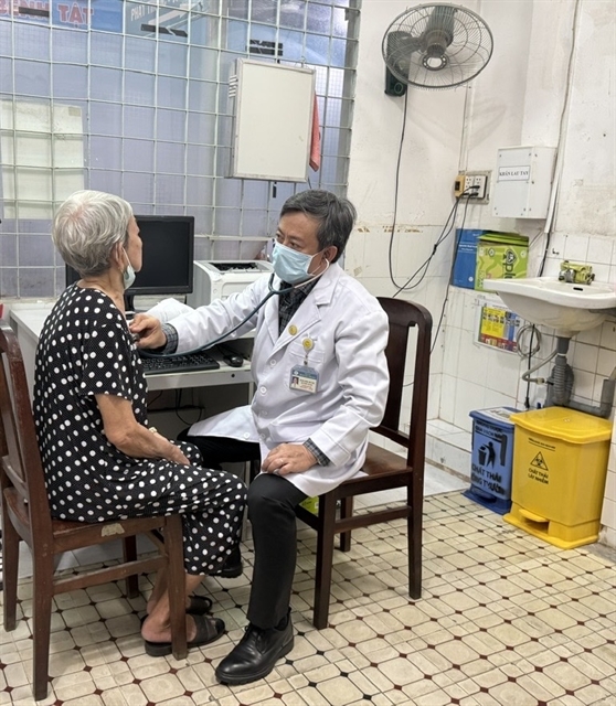
Medical universities in the country need to introduce courses in hospital administration, experts have said.
 Society
Hundreds of households in HCM City have been benefiting from homegrown solar power systems.