.jpg) Society
Society

BVSC General Director criticizes zero-fee policy, emphasises impact on revenue in competitive market
1.
All coastal provinces, especially central localities, have scrambled to prepare for the 10th tropical storm of the year—the strongest to hit the
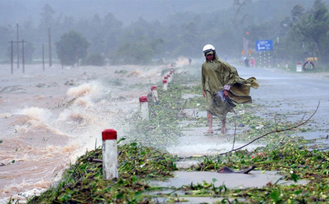 |
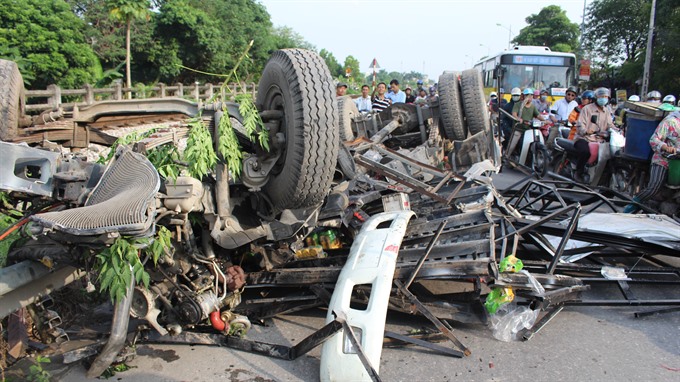
| All coastal provinces, especially in the central region, have scrambled to prepare for the 10th tropical storm of the year—the strongest to hit the East Sea in three years. — Photo soha.vn |
HÀ NỘI — All coastal provinces, especially in the central region, have scrambled to prepare for the 10th tropical storm of the year—the strongest to hit the
The National Centre for Hydro-meteorology Forecasting yesterday said the storm, internationally named Doksuri, was forecast to gain strength and make landfall on the central coastal provinces from Thanh Hóa to Quảng Trị early Saturday. Its current strongest wind speed is 90 km per hour.
In Nghệ An Province, the local administration yesterday informed all vessels about the storm, mobilised all sources to supervise vessels’ voyage schedules and prepared its emergency response plans.
The province had ordered farmers to quickly harvest rice and crops and protect their aqua farms before the storm came in order to minimize damage.
The local administration also said that in some remote areas, the lack of television and radio made it difficult for the authorities to inform people about the development of the storm.
In the meantime, in
The authorities continued updating vessels on the development of the storm and alerted them about dangerous areas to ensure their safety.
Relevant agencies had checked areas with high risks of landslides and flash floods to make plans for evacuating local residents to safe places.
Urgent meeting
Prime Minister Nguyễn Xuân Phúc yesterday afternoon sent an urgent message to ministries and localities to direct them to prepare for the storm. Phúc said it would be a strong storm and ordered all relevant agencies to cancel all non-urgent meetings to be on full elert.
In response to the situation, Minister of Agriculture and Rural Development and Central Steering Committee on Natural Disasters Prevention and Control Nguyễn Xuân Cường hold an urgent meeting yesterday morning to ask the localities to prepare to cope with the storm.
Cường said, “The situation now is very urgent because it is a strong storm and its impact scale could reach 500-600km.”
He required all coastal provinces from Quảng Ninh to Bình Định to ban seafaring beginning Thursday (September 14) to ensure safety for both people and vehicles.
The fishing surveillance force was told to immediately report the number of vessels on the sea and quickly inform the vessels about the dangers of the storm, he said.
The localities were told to check their reservoirs to make preparations for potential floods, he added.
Cường said the water level of Hồng (Red) River was now high while reservoirs in the north and north-central were nearly full. Major hydro-power plants’ reservoirs in the north opened six floodgates.
If torrential rains occur during the storm, the Hòa Bình Reservoir might have to open five floodgates. This could threaten the safety of local people living in the downstream area of Hồng (Red) River, he said.
Cường ordered the Việt Nam Television, the Vietnam News Agency and the Voice of Việt
Major General Trương Trọng Nghĩa, chief of the National Committee for Search and Rescue’s Office, said the committee was ready to cope with the storm.
Nghĩa said the committee had sent teams to localities to co-operate with local administrations to better prepare for the storm.
Storm developments
By 7pm yesterday, the storm was at 380km to the east of Hoàng Sa (Paracel) Archipelago, with the highest wind speed of 90 km per hour, said the national centre for hydro-meteorology forecasting.
The storm, moving at 15-20km, was expected to gain strength and by 4pm on Thursday reach its strongest wind speed of up to 135km per hour.
Due to the storm, torrential rains with rainfall of up to 400mm were predicted to hit the
Floods were forecast to occur in river systems from
Provinces of Hòa Bình, Sơn La, Thanh Hóa, Thừa Thiên Huế, Hà Tĩnh, Quảng Bình and Quảng Trị were put on high alert for landslides and flash floods.
Urban areas of Hà Nội, Vinh, Hà Tĩnh, Đồng Hới and Huế were warned about inundation triggered by heavy rains, the centre said.
Seas from
Society
 Society
 Society
 Society
 Society
 Society
 Society
 Society
Health authorities in Nha Trang City – the famous beach tourism destination hit hard by HIV/AIDS – have made progress against the epidemic. But their efforts are threatened by a lack of adequate human resources.
 Society
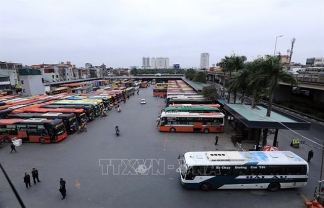
A district in HCM City has stepped up its efforts to respond to residents’ complaints within five seconds via a newly-launched mobile application.
 Society
Nearly 500 CEOs, business owners, investors and economic experts participated in the final pitch at the Swiss Innovation Challenge Việt Nam event with 21 teams competing yesterday in HCM City.
 Society
The relocation of 130 trees planted on Kim Mã Street’s pavement in Hà Nội will be completed within 45 days, according to the Management Board of the Hà Nội Urban Railway project.
 Society
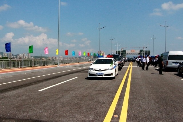
Bắc Luân II Bridge is the promising motivation for China – Việt Nam economic cooperation.
 Society
A collision between a North-South cargo train and a truck occurred early on Wednesday at a railway crossing in Nhị Khê Commune, Hà Nội’s Thường Tín District. The accident caused serious traffic congestion for hours.
 Society
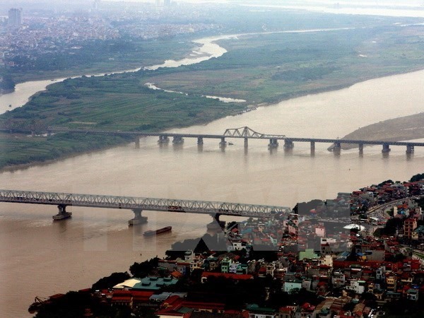
The capital city will build 14 new bridges over the Hồng (Red) and Đuống rivers by the year 2030, said Vũ Duy Tuấn, deputy director of the city’s Planning and Investment Department.
 Society
The Ministry of Agriculture and Rural Development has co-operated with police to combat the illegal injection of gel into shrimps to increase their weight and thus make more money.


.jpg)