 Society

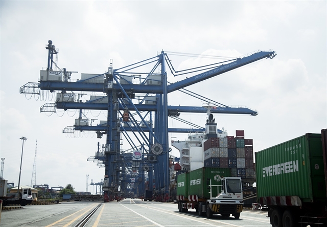
Cooperation with Việt Nam among EU’s priorities in Indo-Pacific: official
1.
Coastal localities, especially central provinces of Thanh Hóa, Nghệ An and Hà Tĩnh, have mobilised all sources to prepare for tropical storm Talas that is predicted to make its landfall on the seashore from Thanh Hóa to Hà Tĩnh by 4am today (Monday) with torrential rains of up to 350mm.
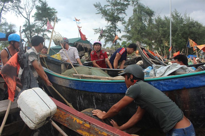 |
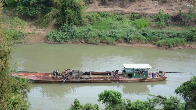
| A fishing vessel is pulled to shore yesterday in Thanh Hóa Province ahead of storm Talas. Coastal localities, especially Thanh Hóa, Nghệ An and Hà Tĩnh Provinces, have mobilised resources to prepare for the storm.—VNA/VNS Photo Duy Hưng |
HÀ NỘI — Coastal localities, especially the central provinces of Thanh Hóa, Nghệ An and Hà Tĩnh, are mobilising all resources to prepare for tropical storm Talas.
Talas is expected to make landfall off the coasts of these provinces at 4am today, bringing torrential downpours of up to 350mm.
The National Centre for Hydro-meteorological Forecasting said the strongest wind speeds at the eye of the storm as it lands would be 75-100km per hour.
Data from Thanh Hóa Province’s Steering Committee on Natural Disaster Prevention and Control says that as of 5pm yesterday, more than 5,000 vessels were safely anchored and over 720 offshore vessels were informed of the storm as well as dangerous areas so that they can actively seek shelter.
The provincial administration has already made plans to evacuate nearly 58,000 households out of areas facing a high risk of landslides and flash floods triggered by the storm.
It has banned all vessels from going out to sea, sent teams to reinforce protection houses and trim trees to minimize damage, store foods to provide emergency rations for affected residents, double check reservoirs to ensure safety during the storm and warned people against swimming in the Sầm Sơn Beach.
Nguyễn Đức Quyền, vice chairman of the provincial People’s Committee, said the administration has asked relevant agencies to work round the clock on updating the status of the storm in order to take prompt action and minimise damages caused.
Similar actions have been taken by authorities in Nghệ An Province, including evacuation of people for high-risk areas, having rescue teams stand ready, and informing all vessels about the storm.
Đặng Ngọc Sơn, vice chairman of People’s Committee of Hà Tĩnh, said the province had re-checked all reservoirs, evacuated people to safe places and reinforced dykes. As of 5pm yesterday, some 6,000 vessels were safety anchored, he said.
Urgent meeting
The Central Steering Committee on Natural Disaster Prevention and Control held an emergency online meeting with 24 localities early yesterday morning to discuss preparedness for the storm.
Hoàng Văn Thắng, Deputy Minister of Agriculture and Rural Development and Vice Chairman of the Steering Committee, said he was very worried about the safety of reservoirs during the storm.
Thắng said that the three provinces of Thanh Hóa, Nghệ An and Hà Tĩnh had 1,350 reservoirs, many of which could fill up as a result of torrential rains.
He has asked authorised agencies in the province to tighten supervision to ensure safety.
He also asked localities downstream the Hồng (Red) River to actively drain water before the storm to ensure the safety of reservoirs and dams during the storm.
All vessels have been banned from going out to sea in all localities before and during the storm. All preparedness work for the storm was to be finished by 5pm yesterday, he said.
Colonel Trần Dương Kiên of the Border Guard Command said coastal localities stretching from Quảng Ninh to Khánh Hòa had informed 66,755 vessels about the storm so that they could find safe places to anchor.
The Dykes Management Department under the Agriculture Ministry figures there are 27 locations along sea dykes that could be affected by the storm, including sections in the provinces of Quảng Ninh, Hải Phòng, Thái Bình, Nam Định and Ninh Bình. These localities have been advised to reinforce their sea dykes before the storm.
Storm developments
Torrential rains with rainfall of 100-350mm, triggered by the second tropical storm hitting the East Sea this year, are predicted to blanket the northern region and several central provinces until Tuesday.
As of 9pm yesterday, the storm was 110km to the east of provinces from Thanh Hóa to Hà Tĩnh with wind speeds of 75-100 km per hour. It was moving west-northwest at 20km per hour.
The storm is set to hit the central part of Laos and weaken as a tropical low-pressure storm by 4pm today, the centre said.
The National Centre for Hydro-meteorological Forecasting also said yesterday that the storm is likely to trigger floods along the Hồng (Red) River as well as rivers in Thanh Hóa, Nghệ An, Hà Tĩnh, Quảng Bình between Monday and Thursday.
The provinces of Lai Châu, Điện Biên, Sơn La, Hòa Bình, Lào Cai, Yên Bái, Hà Giang, Tuyên Quang, Thái Nguyên, Bắc Kạn, Thanh Hóa, Nghệ An, Hà Tĩnh and Quảng Bình have been put on high alert for landslides and flash floods.
Urban areas in Hà Nội, Thái Bình, Ninh Bình and Hải Phòng have been warned of inundation.
In the central and southern part of the East Sea, from Ninh Thuận Province to Cà Mau Province, the sea has been rough since midnight yesterday. —VNS
Society
 Society
 Society
 Society
 Society
 Society
 Society
A national hotline that would provide legal consultation and assistance to victims of sexual abuse and violence will be launched in the near future, according to the Ministry of Labour, Invalids and Social Affairs.
 Society
Bình Định Province People’s Committee has urged sectors and localities to work together to tackle low-quality steel-hulled fishing vessels and to direct fishermen to use quality shipbuilding facilities.
 Society
Doctors at Thủ Đức District Hospital last Wednesday (July 12) successfully performed the first knee replacement surgery and ligament reconstruction on a patient with hemophilia A, a genetic disorder of blood clotting.
 Society
The Ministry of Labor, Invalids and Social Affairs (MoLISA) is setting up a scheme to export high-skilled labour to abroad in an effort to deal with current unemployment at home.
 Society
Vietnamese students have bagged three gold medals and one silver at the 49th International Chemistry Olympiad in Thailand, the Ministry of Education and Training announced today.
 Society
Exacerbated landslide along the Đồng Nai River in the south has forced Đồng Nai and Lâm Đồng authorities to suspend all sand mining activities in the area despite granted legal licences.
 Society
Pollution, fishing by electric shock tools and explosive, rapid infrastructure for tourism service as well as poor co-ordination mechanism among state agencies and local administrations have seen as major challenges for protection and management at Marine-protected areas (MPAs).
 Society
The Tây Ninh Province Department of Transport has green lighted Tây Ninh Tourist Trading Joint-stock Company’s proposal to operate electric buses on a trial basis in downtown Tây Ninh city and Hòa Thành District from early next year.
 Society
Over 100 participants attended a forum held yesterday in Hà Nội to discuss and gain a greater understanding of Việt Nam’s legal framework addressing child sexual exploitation, with a particular focus on child sex tourism.