 Environment

Proposal to abolish quotas on Vietnamese shrimp imported into South Korea
1.
|
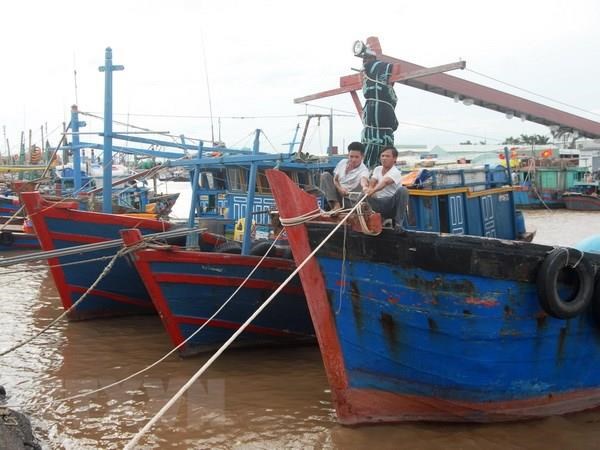
| The Central Steering Committee on Natural Disaster Prevention and Control has asked its sub-committees, relevant ministries and sectors to brace for a tropical storm that is moving towards Viet Nam. — VNA/VNS Photo Lâm Khánh |
“Ministries and sectors should proactively respond to the tropical depression and keep a close watch on its course,” Nguyễn Hoàng Hiệp, deputy minister of Agriculture and Rural Development said at a meeting held yesterday in Hà Nội to discuss measures to cope with the tropical storm in the East Sea.
The National Hydro-Meteorological Forecasting Centre was asked to closely monitor the development of the tropical depression and issue forecasts and warning messages. 24-hour forecasts should also be aired to help areas in the path of the storm to take preventive measures, particularly in northern mountainous provinces.
Coastal localities should regularly notify owners and captains of ships operating at sea on the development of the storm so they could avoid dangerous areas.
The Directorate of Water Resources and the Department of Dyke Management were ordered to inspect and prepare measures to ensure the safety of dykes, dams and reservoirs, especially in an emergency situation.
Localities were instructed to develop evacuation plans in low-lying areas and those at high risk of flash floods. Rescue personnel and equipment must be on standby for any emergency.
As of 6am on Tuesday, border guard forces had been working with local authorities, boat owners and captains to inform more than 28,641 vessels carrying around 103,267 sailors of the development and direction of the storm so they could find shelter and escape hazardous zones.
On Tuesday morning, the system was located 190 km off the East Sea’s northeastern territorial waters and Hoàng Sa (Paracel) archipelagoes, with maximum sustained winds of between 40 and 60 km per hour near the centre.
By 1pm on Wednesday, it will be at the Hainan Island’s eastern territorial waters with winds of 60- 75 km per hour.
The storm will continue moving west- northwest at speeds of 15 km per hour towards the territorial waters of Quảng Ninh to Nam Định provinces.
The influence of the storm along with high sea surface temperatures will create favourable condition for the tropical storm to make landfall in Việt Nam. It will trigger heavy downpours in the North and North-Central region on Wednesday and Thursday with average rainfall of 100-250mm. Flash floods and landslides are forecast for these regions.
Floods are predicted to occur on rivers in provinces from Thanh Hóa to Hà Tĩnh with water levels rising from 2-5m. — VNS
Environment
 Environment
 Environment
 Environment
 Environment
 Environment
 Environment
 Environment
 Environment
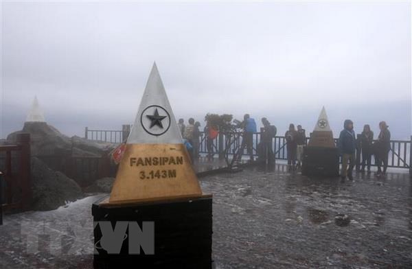
Mount Fansipan in the northern mountainous province of Lào Cai, the highest mountain in Indochina, is actually four metres higher than previously thought, standing at 3,147.3 metres above sea level.
 Environment
 Environment
 Environment
 Environment
 Environment
Along with professional journalists, local villagers and citizens play an important role in gathering and reporting environmental news, experts have said.
 Environment