 Environment

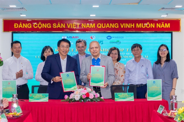
Forum discusses support for women-owned firms to join supply chains
1.
The National Centre for Hydro-meteorological Forecast has reported that in the past six hours, tropical storm Mawar has remained almost unchanged.
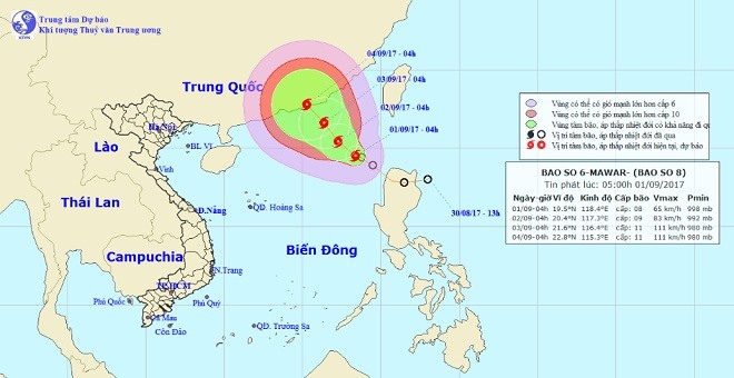 |
| Photo shows the direction of tropical storm Mawar. — Photo The National Centre for Hydro-Meteorological Forecasting |
HÀ NỘI — The National Centre for Hydro-meteorological Forecast has reported that in the past six hours, tropical storm Mawar (the eighth typhoon this year) has remained almost unchanged.
At 7am on Friday, the eye of storm was located around 550km southeast of Hong Kong (at 19.7 degrees north latitude, 118.3 degrees east). The strongest winds at the centre was at level 8, meaning a wind speed of up to 60 to 75km per hour.
Over the next 24 hours, the typhoon will head in a north-west direction slowly, at 5km per hour, and likely increase pace later.
By 7am Saturday, its location will be around 370 km east of Hong Kong (at 20.8 degrees north latitude, 117.2 degrees east). The strongest winds near the eye of the storm will increase to level 9-10 (75-100km per hour), the centre has forecast.
Due to the typhoon, the north-east part of East Sea will be rough and see powerful waves as well as strong winds of level 6-7, while the area near the storm centre will see wind speeds of level 9-10.
For the next 24 to 48 hours, the typhoon will continue to head north-west, moving at 10km per hour. By 7am on Sunday, it will hit the southeast coast of China’s Guangdong Province (22.2 degrees north, 115.8 degrees east). Wind speeds will strengthen near the centre of the storm to level 10-11 (90-115km per hour).
According to the centre, the typhoon season in 2017 will bring 13 to 15 typhoons and tropical depressions in the East Sea, one or two more compared to the average of 12 storms in the previous years. Of these, three or four storms will directly hit mainland Việt Nam, most likely the central region.
On Wednesday, the Central Steering Committee for Natural Disaster Prevention and Control sent an urgent alert on the direction of the typhoon to coastal provinces from Quảng Ninh to Phú Yên, while ministries informed ship owners and local fishermen about the development.
On Thursday morning, the committee ordered Tuyên Quang Province’s hydropower plant to open a floodgate at midnight the same day to reduce its water level.
Between August 28 and 30, due to impact of tropical depression in the northern mountainous province of Yên Bái, one person died, one house collapsed and six others were damaged, over 2.7ha of rice and aquaculture cultivation were destroyed, causing an estimated loss of VNĐ250 million (US$11,000), the committee has reported. — VNS
Environment
 Environment
 Environment
 Environment
 Environment
 Environment
 Environment
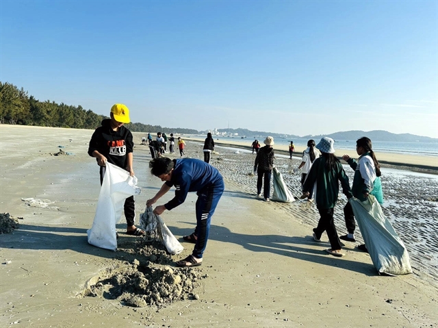
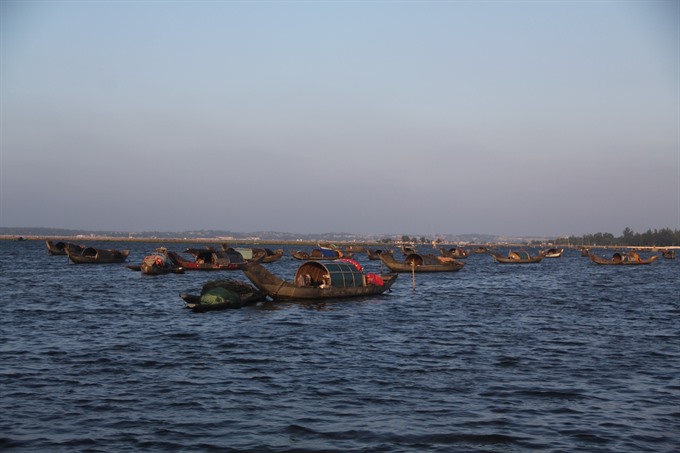
A total of 300,000 ocean fingerlings were released into an area of Tam Giang Lagoon in central Thừa Thiên- Huế Province, aiming to produce a swift recovery for local seafood resources after the Formosa toxic spill in 2016.
 Environment
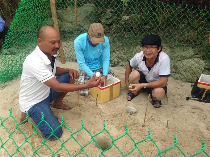
Chàm Island Marine Protected Area has started conservation of the green turtle (Chelonia mydas) by hatching 450 eggs taken from Côn Đảo Island.
 Environment
There have been at least five clashes recently between wild elephants in search of food and tame elephants in the Central Highlands province of Đắk Lắk’s Buôn Đôn District.
 Environment
Plans to implement the Paris Agreement on climate change in the northern part of Việt Nam were the focus of a conference held in Hà Nội yesterday.
 Environment
The city has seen positive results from its programmes on “building a civilized city without waste”, according to participants at a meeting held by HCM City’s Việt Nam Fatherland Front Committee on Tuesday (August 29).
 Environment
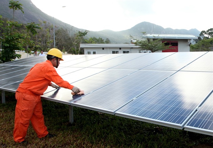
The People’s Committee of southwestern Tây Ninh Province has proposed the Ministry of Industry and Trade (MoIT) add 15 solar power projects to the provincial planning scheme on electricity development in the 2011-15 period, with a vision through 2020.
 Environment
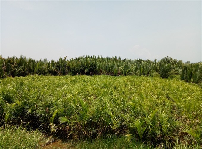
A planned wood-pulp plant in Bình Sơn district would destroy 50ha of nipa palm forest, causing pollution, loss of biodiversity, and irrevocable damage to local lifestyles, biologists and residents warn.
 Environment
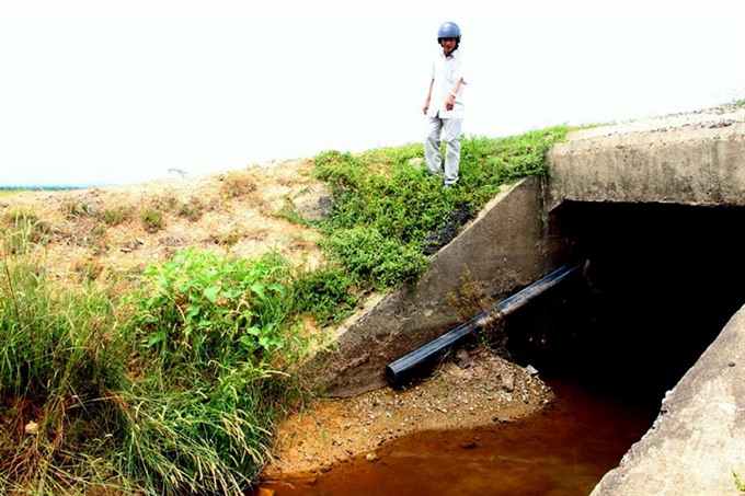
The Vinatex International Toms Textile Garment Co Ltd plans to set up a waste water pipe in Hải Thọ Commune, but local residents aren’t happy.
 Environment
Việt Nam has been making efforts to mobilise international and domestic sources in order to support national energy development and achieve a sustainable energy system with low emissions, experts have said.
.jpg)